ARCHAEOLOGY - SZADZKO
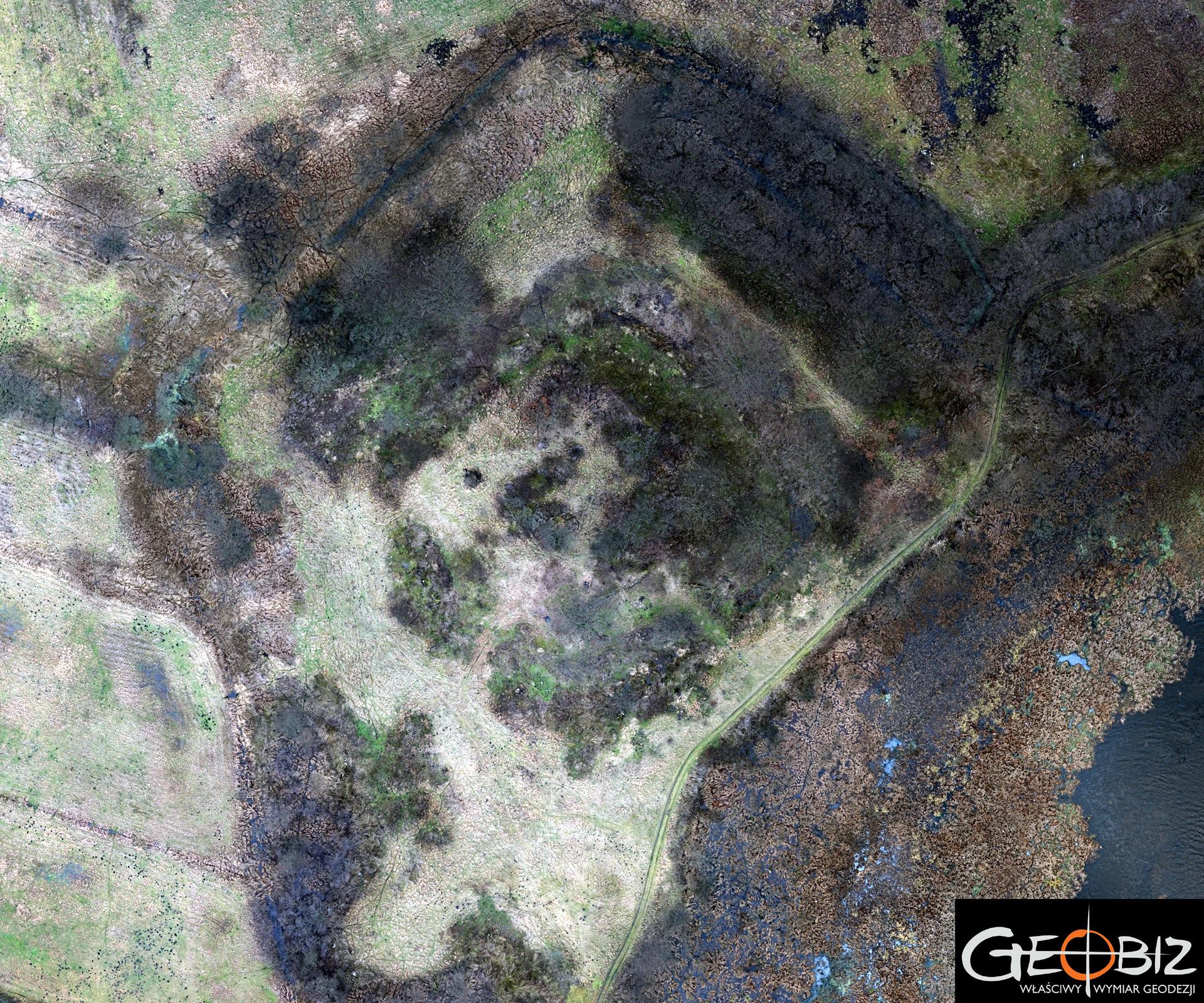
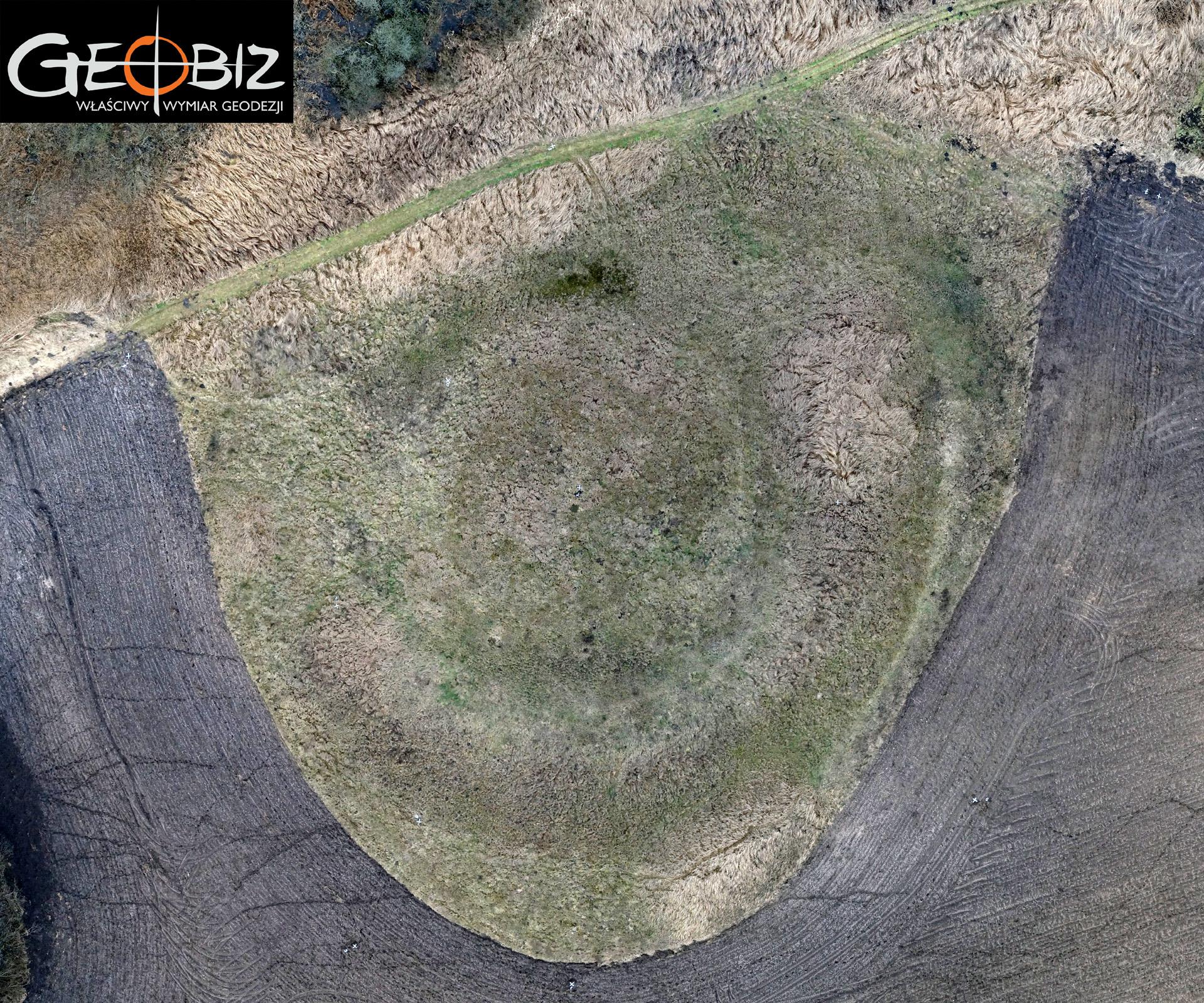
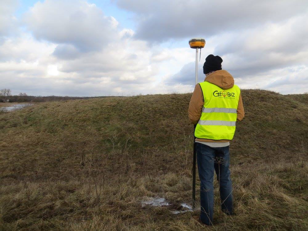
In collaboration with Mr. Grzegorz Szalasta from the Department of Archaeology at the University of Szczecin, we carried out digital documentation of archaeological sites in the West Pomeranian Voivodeship. The first of two sites is a settlement, while the second consists of the remnants of a princely castle. Aerial images obtained during UAV flights were used to develop digital models of both sites.
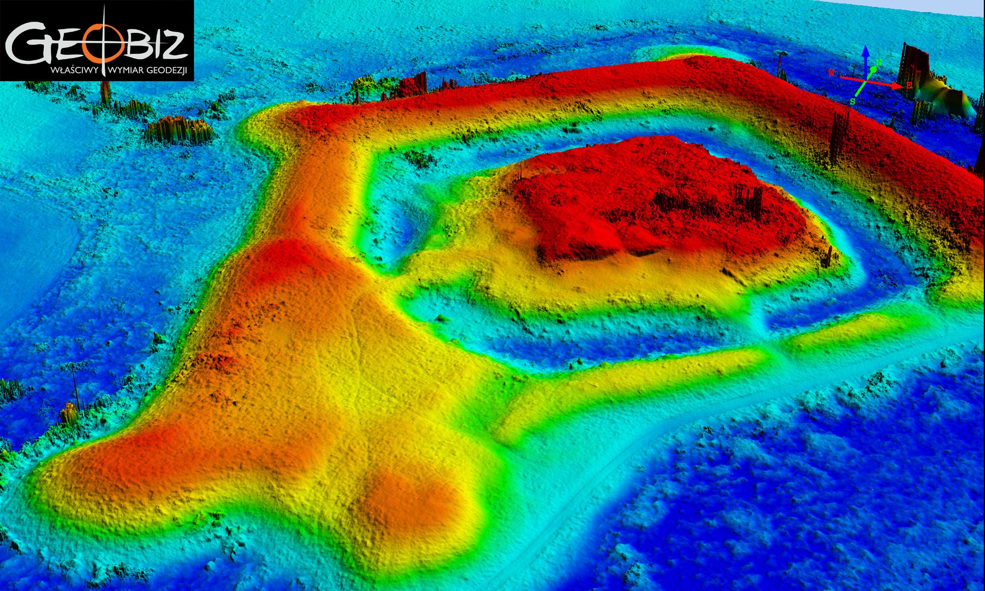
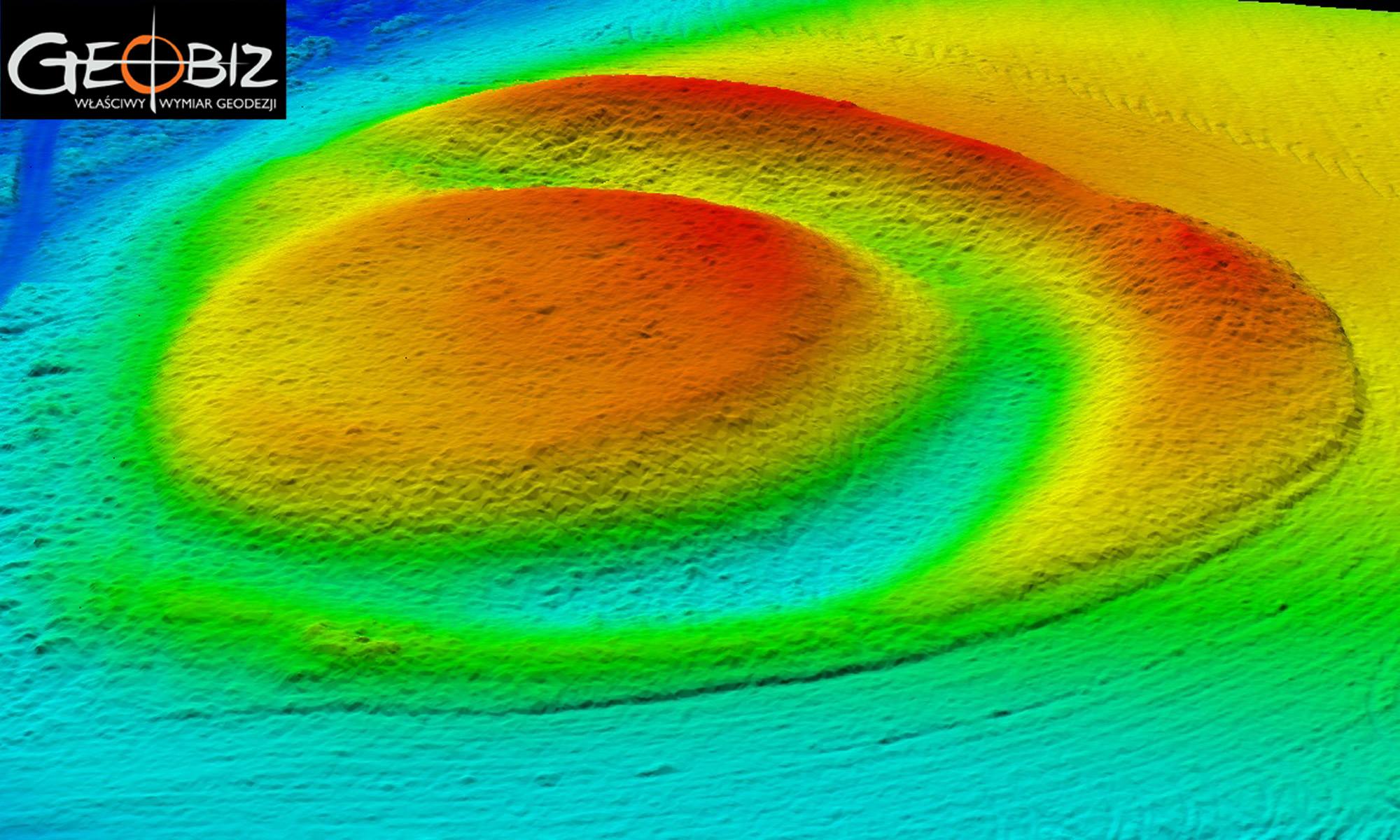
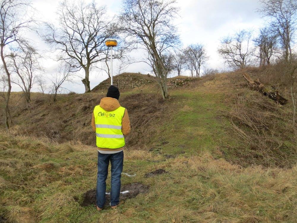
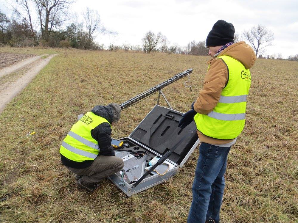
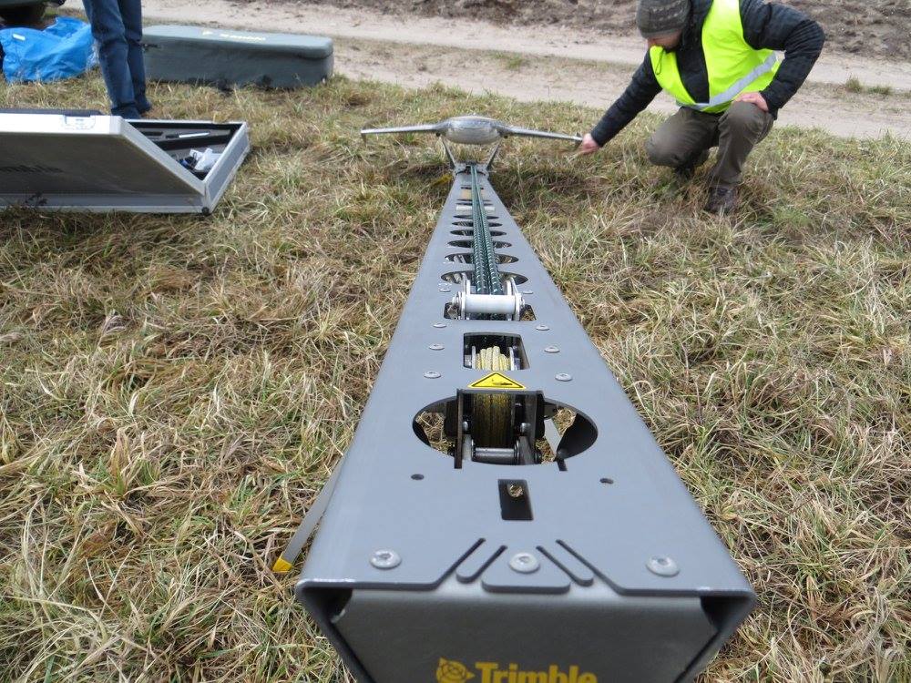
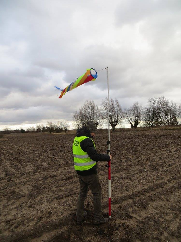
The flight for this research was conducted on January 29, 2015, using the Trimble UX5 Unmanned Aerial System (UAS), equipped with a non-metric Sony NEX-5T digital camera (16.1 MP). During the mission, the UAS captured 32 strips of photographs with a cross overlap of 80% and a longitudinal overlap of 80%. The flight at an altitude of approximately 80 m enabled the capture of images with a ground pixel size of about 2.5 cm. The fieldwork, which included the arrangement and measurement of photo points, preparation of equipment, and execution of the flight, took about 120 minutes. The primary objective of this project was to assess the capabilities of the fixed-wing UAV for documenting archaeological sites with distinct landscape forms. Therefore, the flights were conducted for two sites with varying characteristics. The first was a settlement covered only by low vegetation, while the second comprised the remains of a castle partially overgrown with shrubs and trees. To make the trial as reliable as possible, the decision was made to conduct the flight in winter, when the vegetation is dormant.
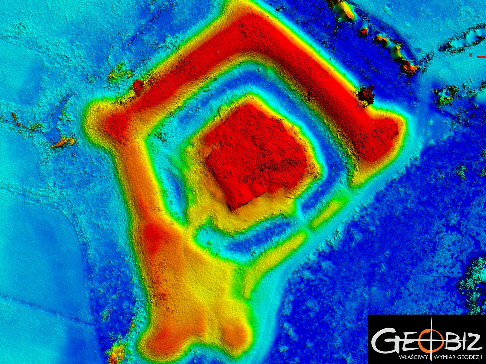
The reference point for assessing the quality of the obtained data was a point cloud from airborne laser scanning conducted as part of the ISOK project. As expected, the UAV performed very well over the settlement. The processed images enabled the generation of a dense point cloud that accurately reflected the terrain's topography. The results from the second site were more challenging to evaluate. Clusters of trees and shrubs led to the formation of "white spots" and poorer terrain representation. Interestingly, the area beneath individual trees was satisfactorily represented. The results of the research were presented at Cardinal Stefan Wyszyński University in Warsaw during the conference "Digitization in the Sciences of the Past and Heritage Protection – Analysis of Potential and Threats."

Services in the field Photogrammetry - offer
Orthophotomaps
MAPS AND 3D MODELS OD OPENCAST MINES
PHOTO REPORTS FROM DRONE AND 360 CAMERAS
AERONAUTICAL PHOTOGRAMETRY
INVENTORY OF BULK MATERIAL STOCKPILES
CONSTRUCTION PROGRESS INVENTORY
We perform periodic measurements as the basis for the closure and settlement of construction stages.
CONTACT
We encourage you to send an inquiry, and we will prepare a personalized offer for you.