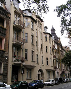
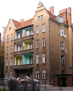
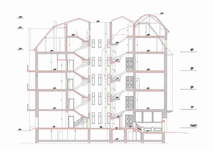
INVENTORY OF A TENEMENT HOUSE IN POZNAŃ
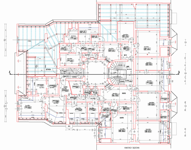
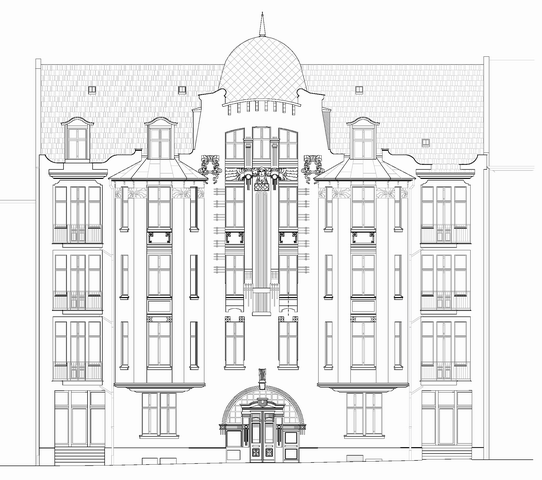
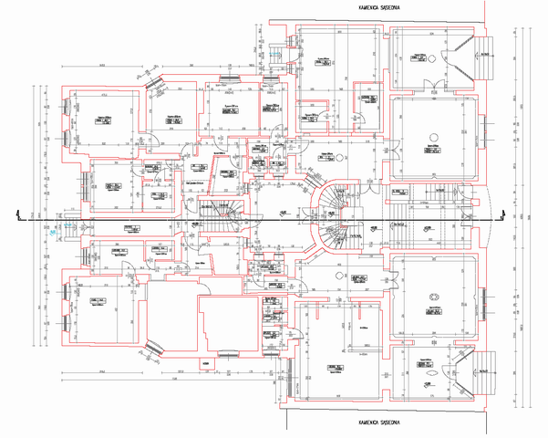
In 2008, comprehensive measurements were conducted on a tenement house, including:
-
A very precise measurement of the elevation of the tenement using a "total station" geodetic instrument with non-prismatic distance measurement based on a previously established control network, resulting in a three-dimensional model of the tenement. This model was helpful in developing the individual floors, cross-sections of the tenement, and elevations.
-
Interior measurements of the tenement: measuring each room with a precise handheld distance meter ("Disto") and measuring the attic and roof structure using a geodetic tachymeter in non-prismatic measurement mode.
-
Leveling of the floors in the tenement using the geometric leveling method, allowing for high measurement precision (leveling error below 2 cm).
-
Processing of measurement results using C-geo software and Autodesk AutoCAD.
Architectural and Construction Inventory is Required in the Following Cases:
-
Renovation, reconstruction, or extension of a building
-
Replacement of the roof structure
-
Enlargement or creation of new window openings
-
Assessment of technical condition
-
Separation of individual land and mortgage registers for separate residential and commercial units
-
When determining the area subject to property tax
Stages of Order Execution:
-
Acceptance of the Order: Registering a new order containing: client details, information about the object, and the scope of work to be carried out.
-
Transfer of All Available Documents: The client provides all preserved documents related to the building.
-
Setting a Measurement Date: Informing residents or users about the planned work on the property.
-
Carrying Out Measurement Work: Based on the analyzed documents.
-
Preparation of Appropriate Documentation: In accordance with the scope agreed upon during the order placement.
The completion time mainly depends on the size of the object being surveyed and the specific requirements of the client.
Services in the field Skanning 3D - offer
CONSTRUCTION AND ARCHITECTURAL INVENTORIES
Reverse documentation based on laser scanning data
VOLUME OF PRISMS UNDER ROOFS AND IN HALLS
Inventory of loose materials in warehouses under the roof and in the halls.
DIGITAL TERRAIN MODEL
3D terrain modeling based on point clouds from laser scanning and photogrammetry.
BUILDING AREA MEASURMENT
Measurement of the usable area of buildings in accordance with applicable standards.
BALANCE OF EARTH WORKS
Calculation of the amount of earthworks actually performed
INVENTORY OF DAMAGES AND MONITORING CHANGES
Precise measurement of damage after collisions and accidents
CONTACT
We encourage you to send an inquiry, and we will prepare a personalized offer for you.