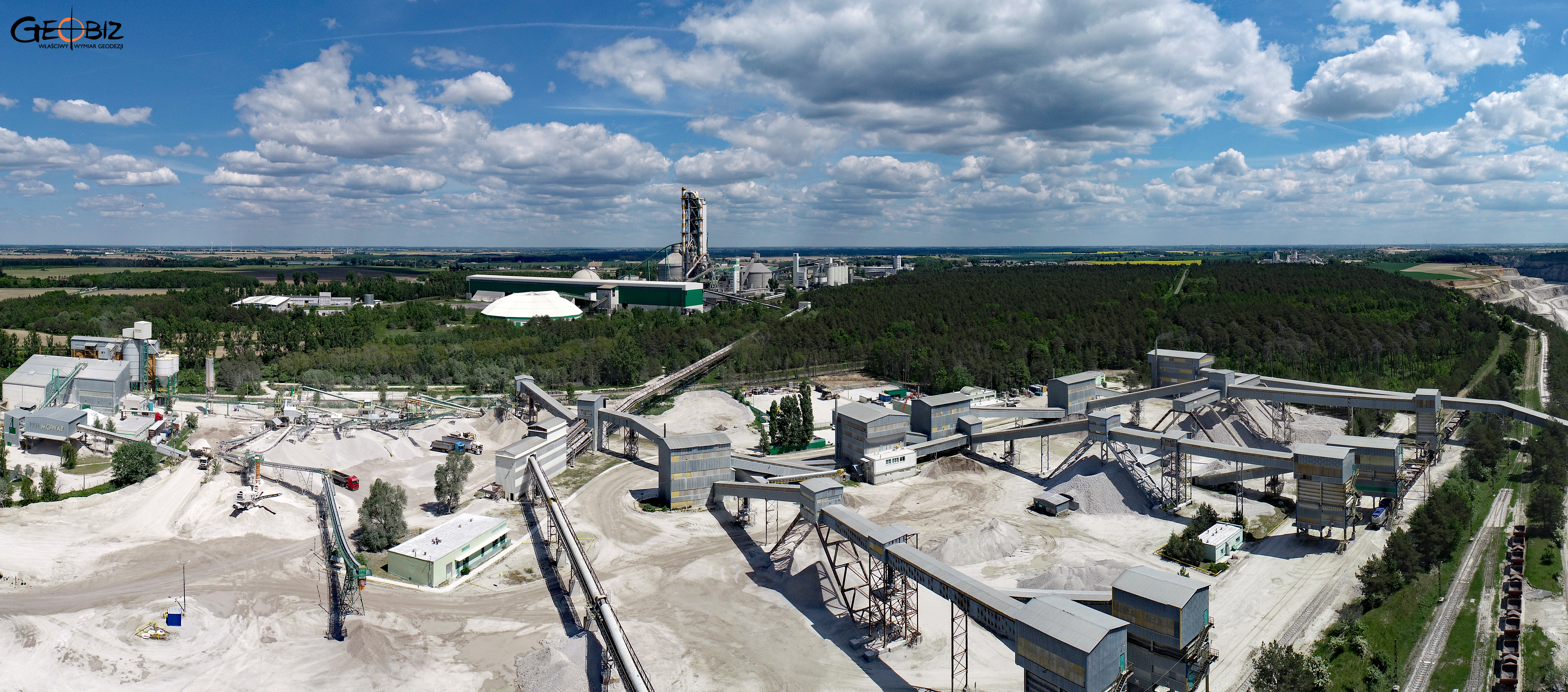
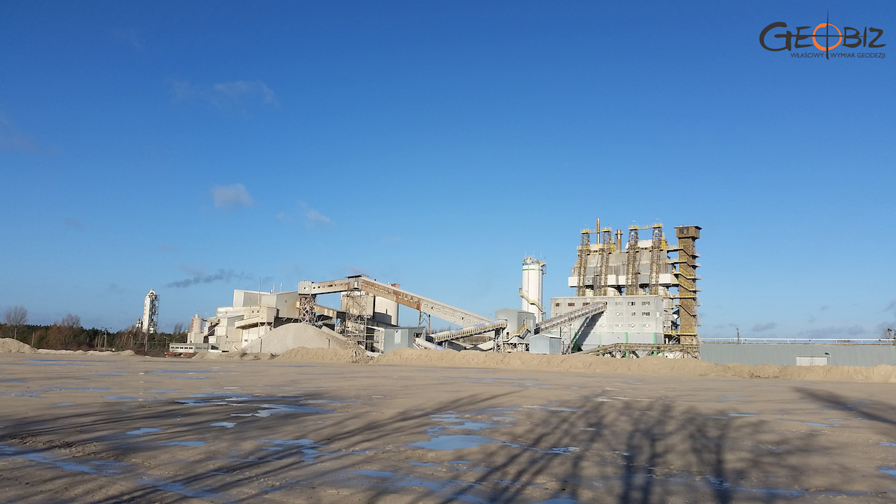
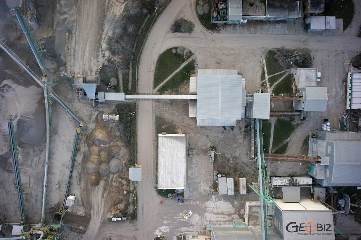
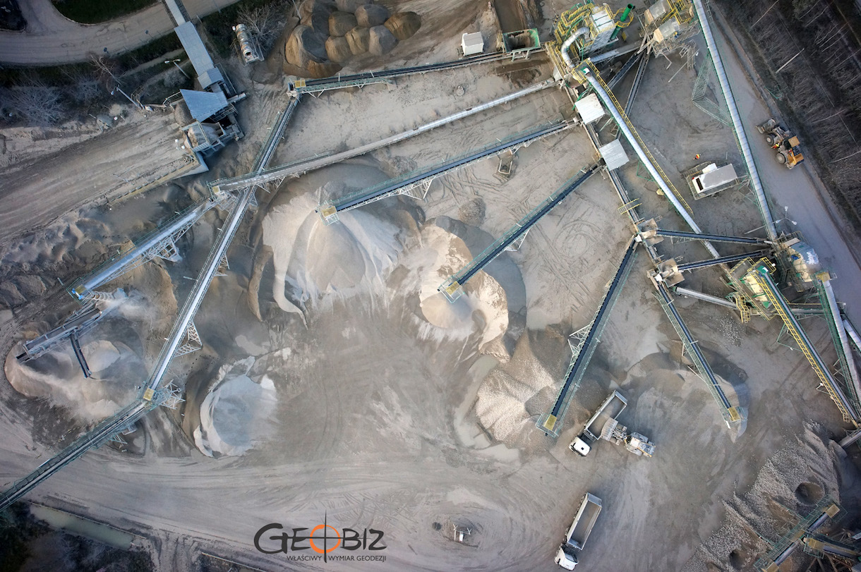
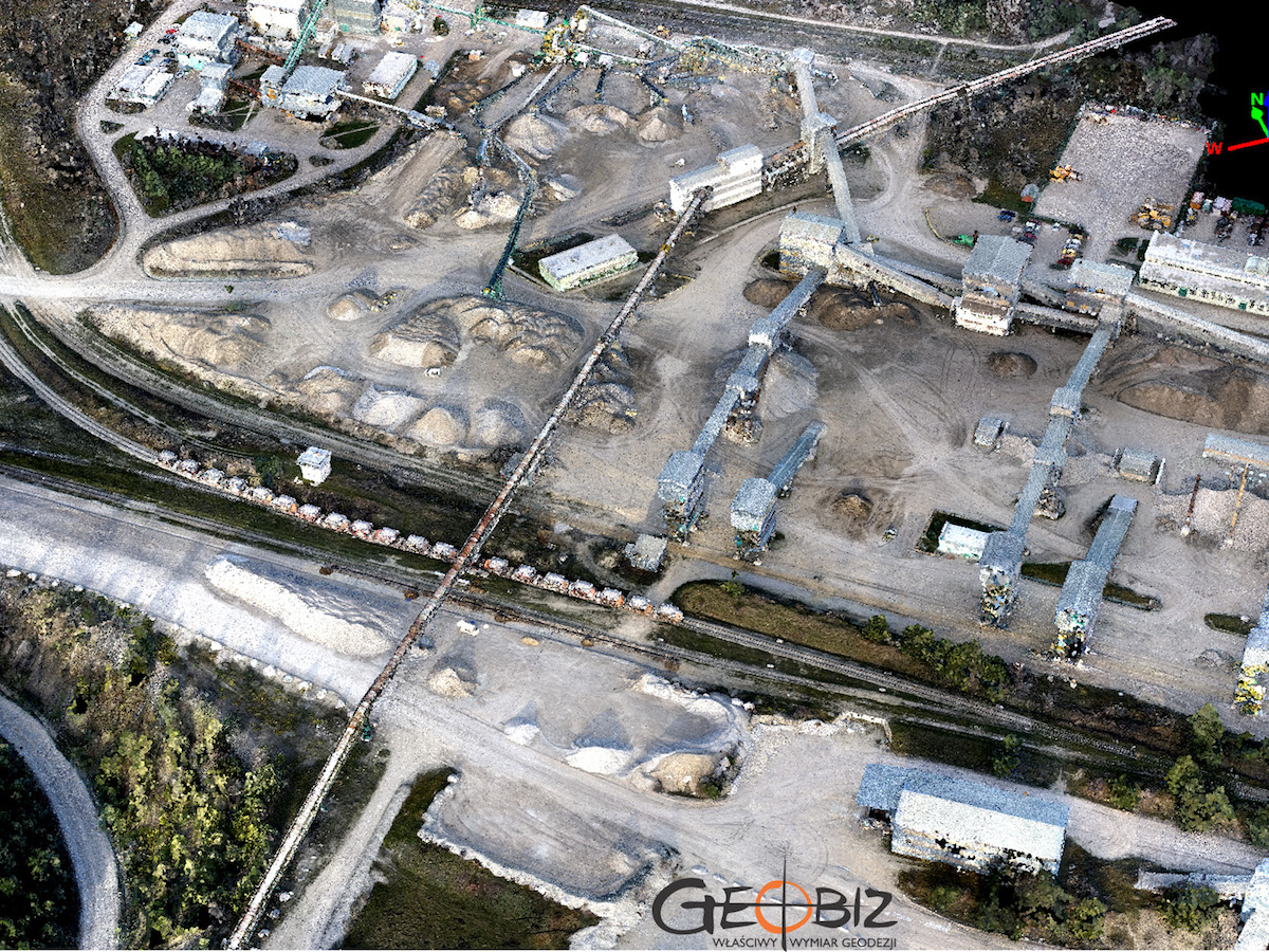
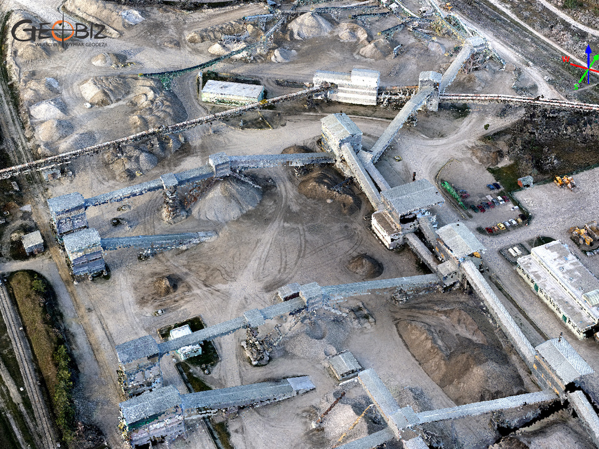
KUJAWY MINE
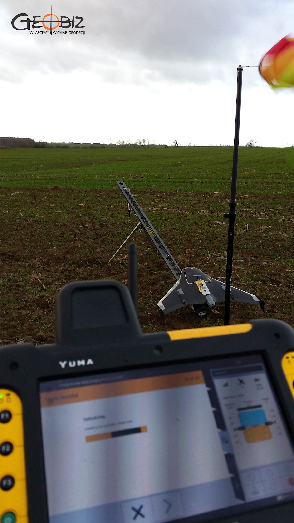
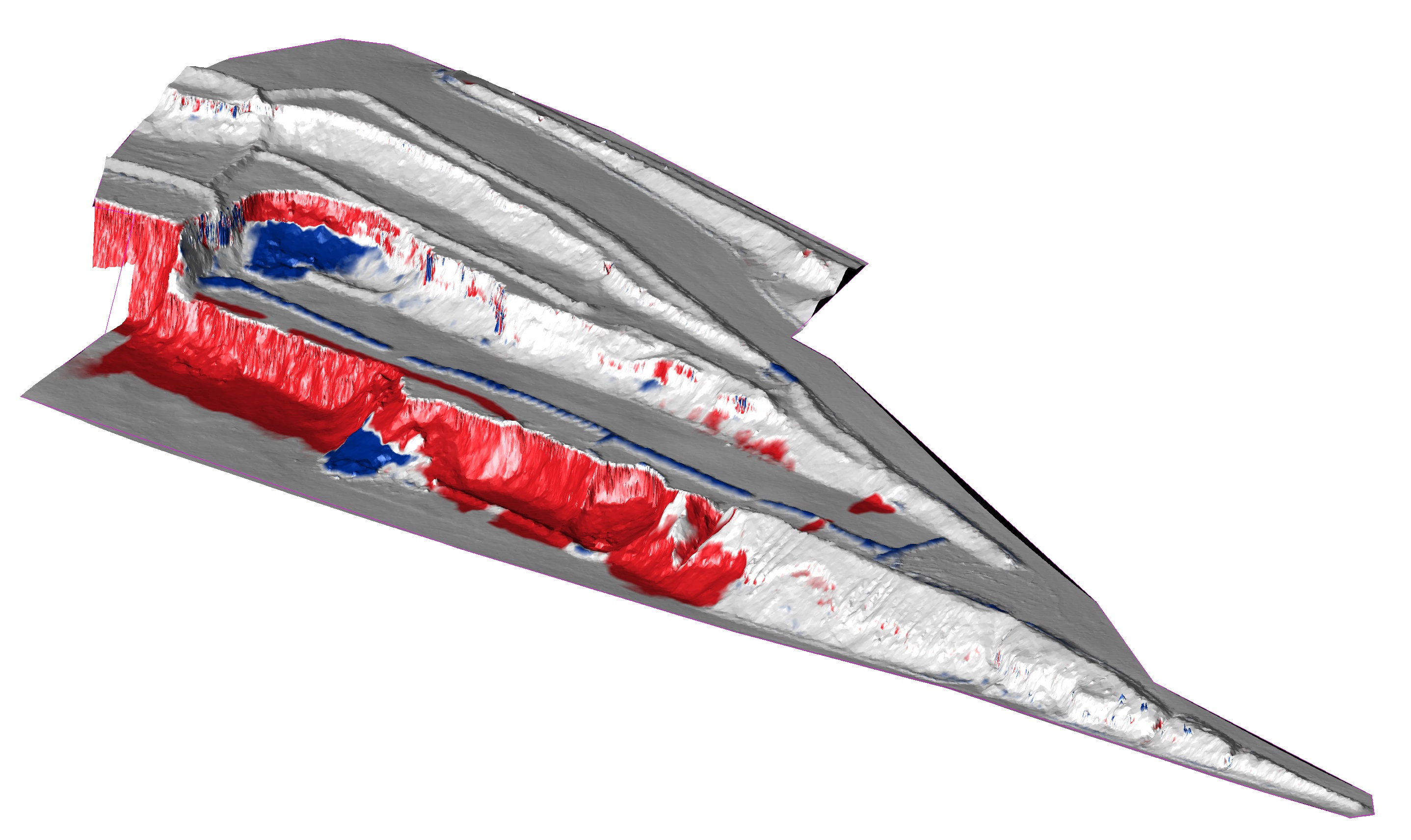
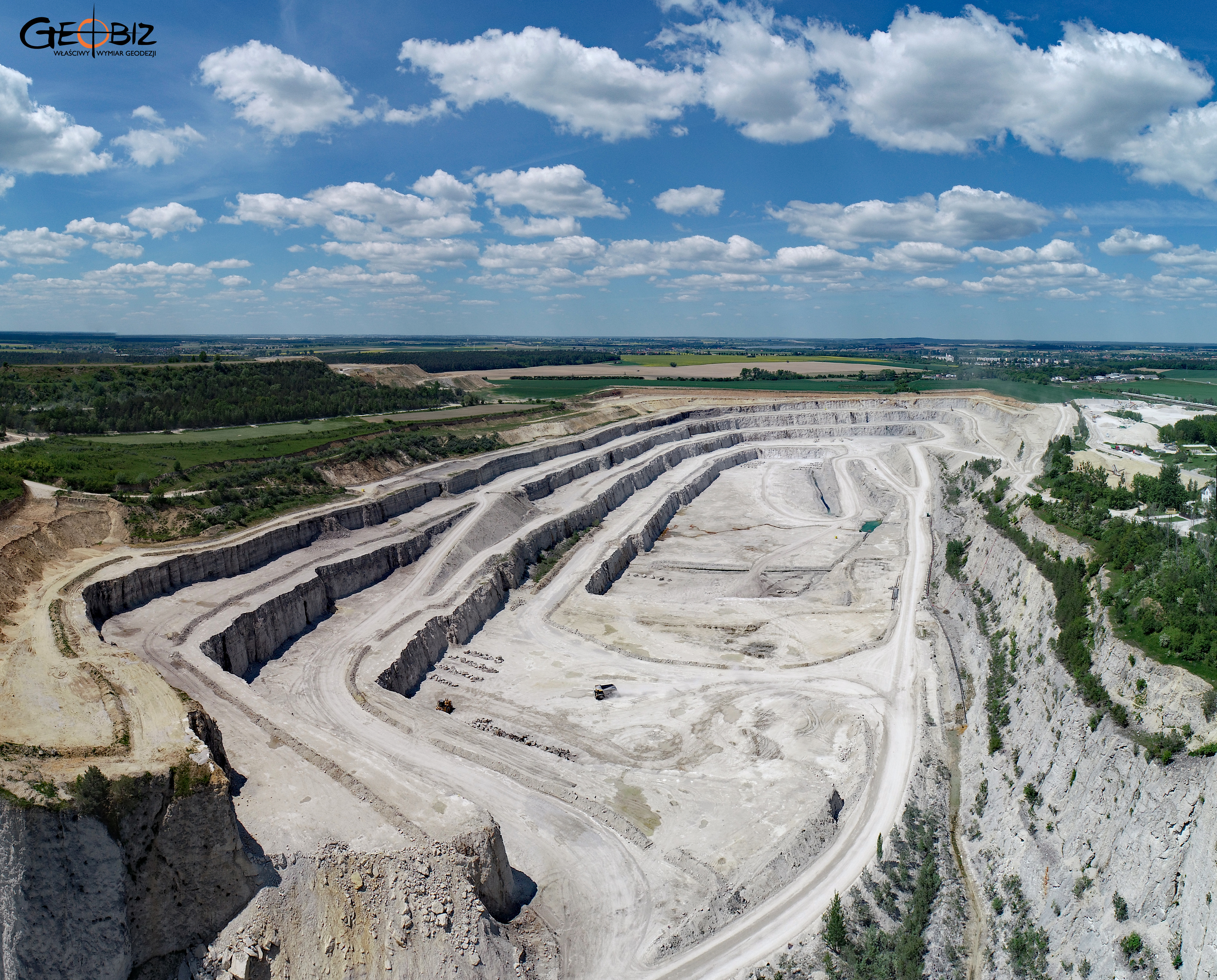
Several times a year, we are asked to inventory product stocks at the Kujawy mine near Barcin. Naturally, we use close-range aerial photogrammetry for this task. It’s usually challenging because the client requires measurements to be taken on a specific day, and, as is often the case, the wind ends up being far too strong, with gusts reaching up to 70 km/h. Nonetheless, we manage to complete the flights, though we’ve seen the plane almost hovering in the air, lacking the power to reach the landing site. We’ve certainly learned the limits of our equipment. The aerial survey produced a dense point cloud with a resolution below 4 cm GSD. We calculated the volume of over a hundred stockpiles, prepared calculation reports, and created graphical attachments.
Services in the field Photogrammetry - offer
Orthophotomaps
MAPS AND 3D MODELS OD OPENCAST MINES
PHOTO REPORTS FROM DRONE AND 360 CAMERAS
AERONAUTICAL PHOTOGRAMETRY
INVENTORY OF BULK MATERIAL STOCKPILES
CONSTRUCTION PROGRESS INVENTORY
We perform periodic measurements as the basis for the closure and settlement of construction stages.
CONTACT
We encourage you to send an inquiry, and we will prepare a personalized offer for you.