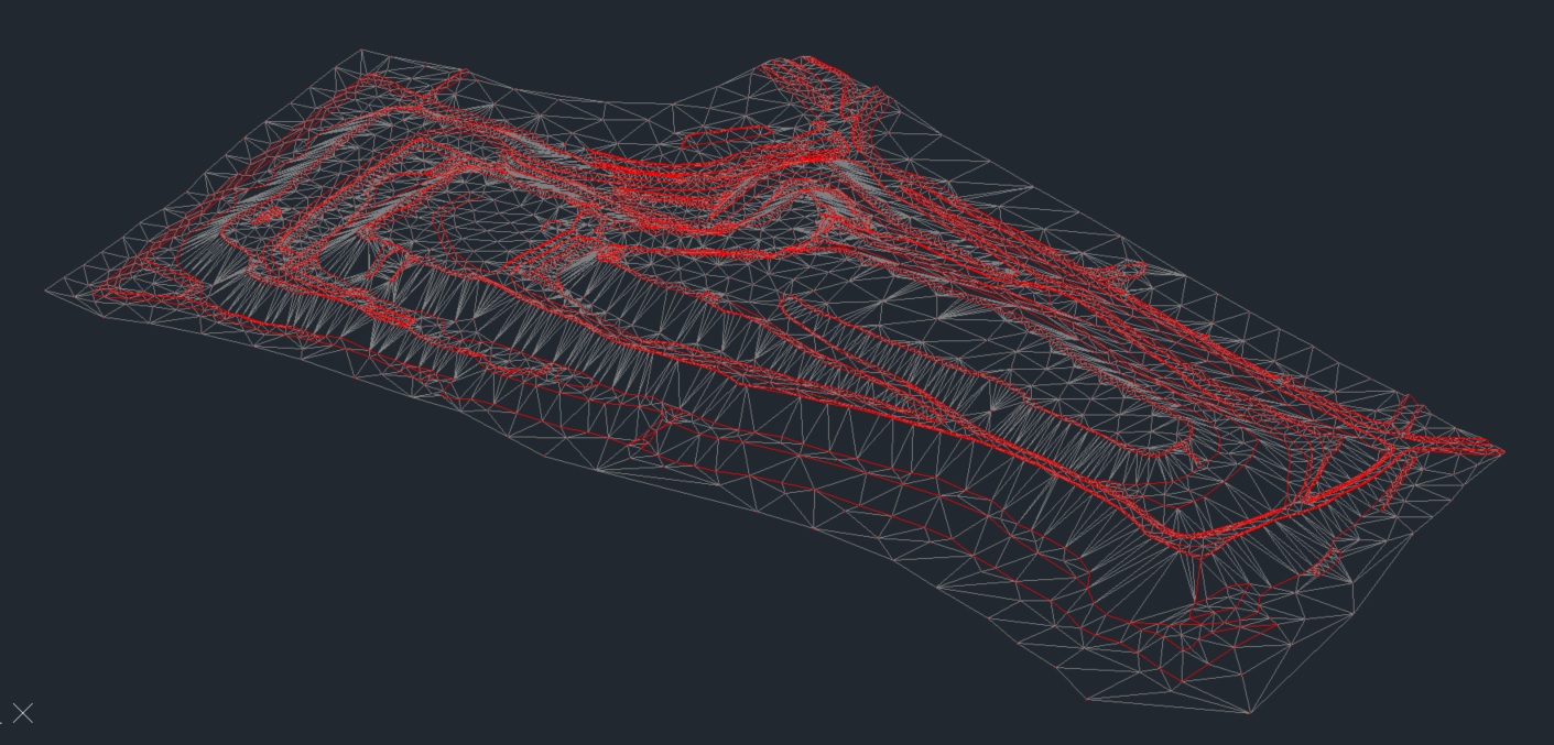
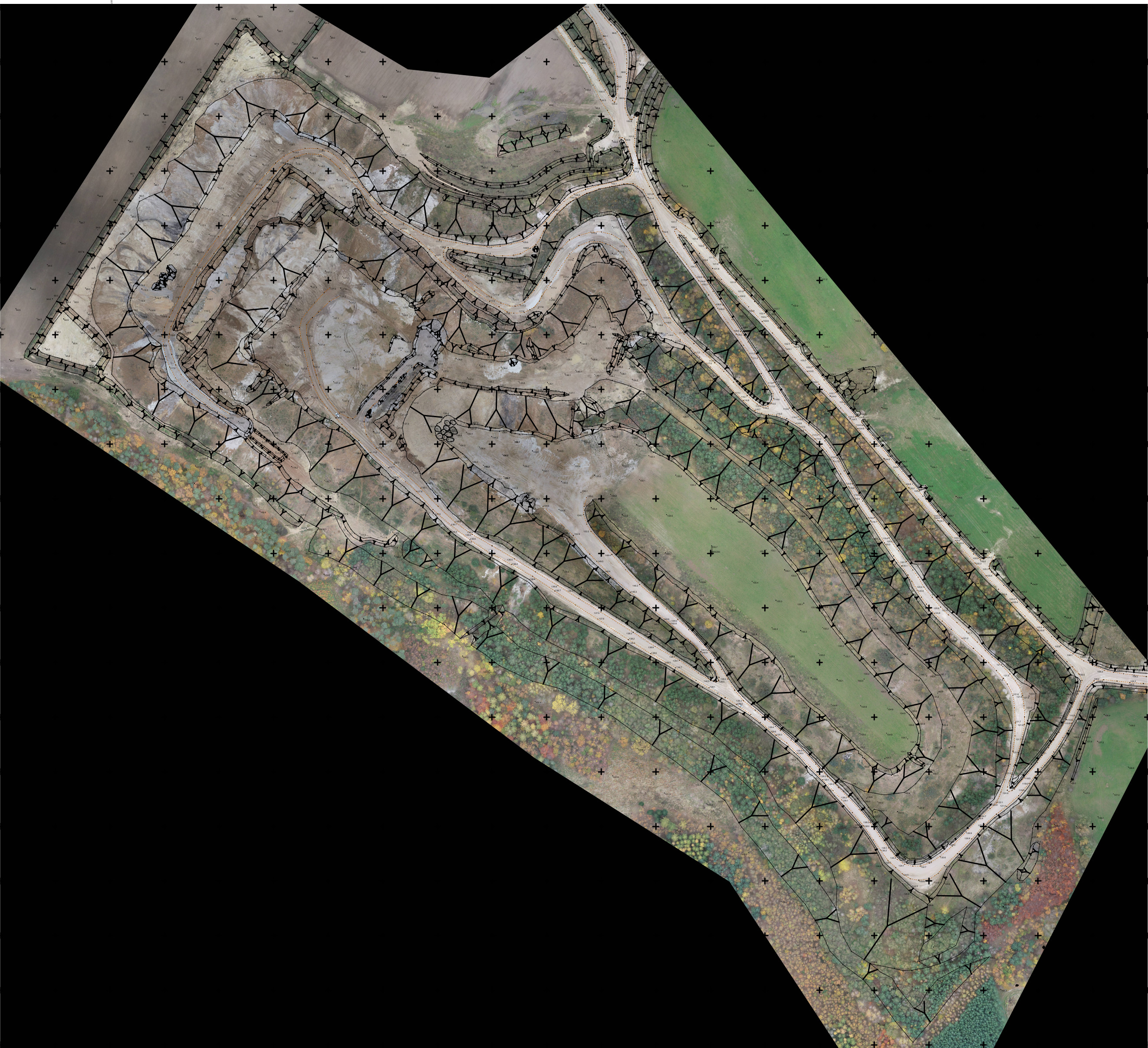
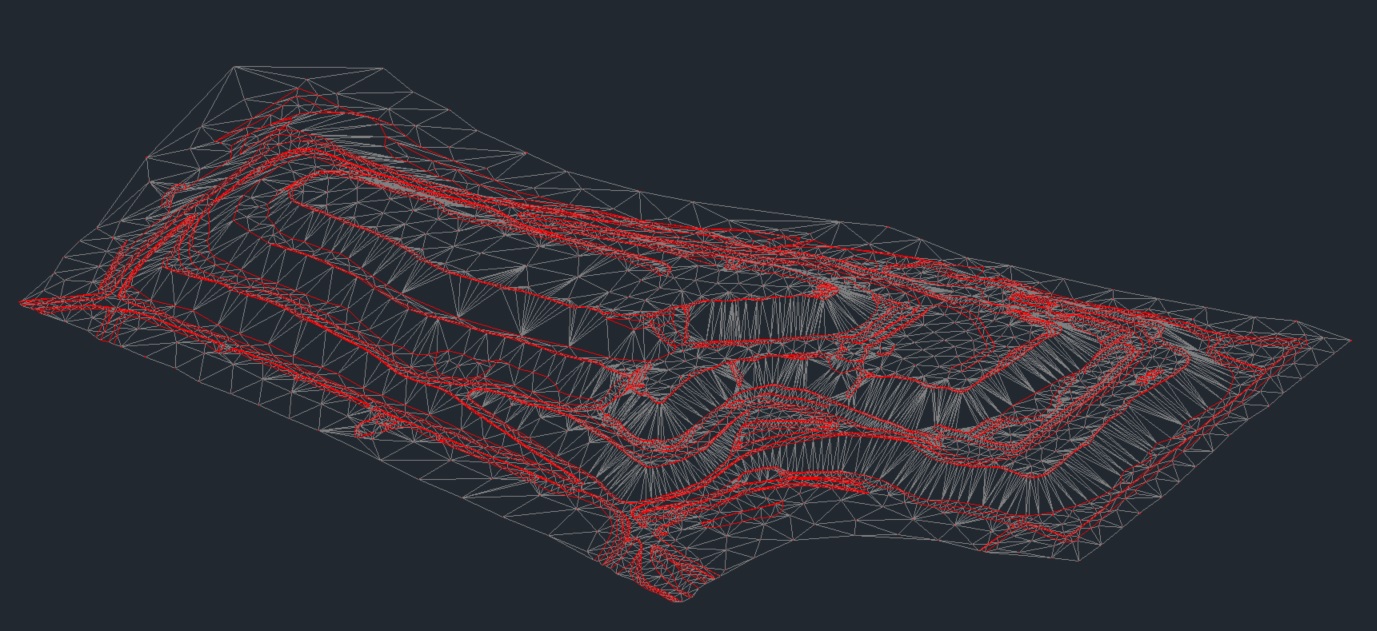
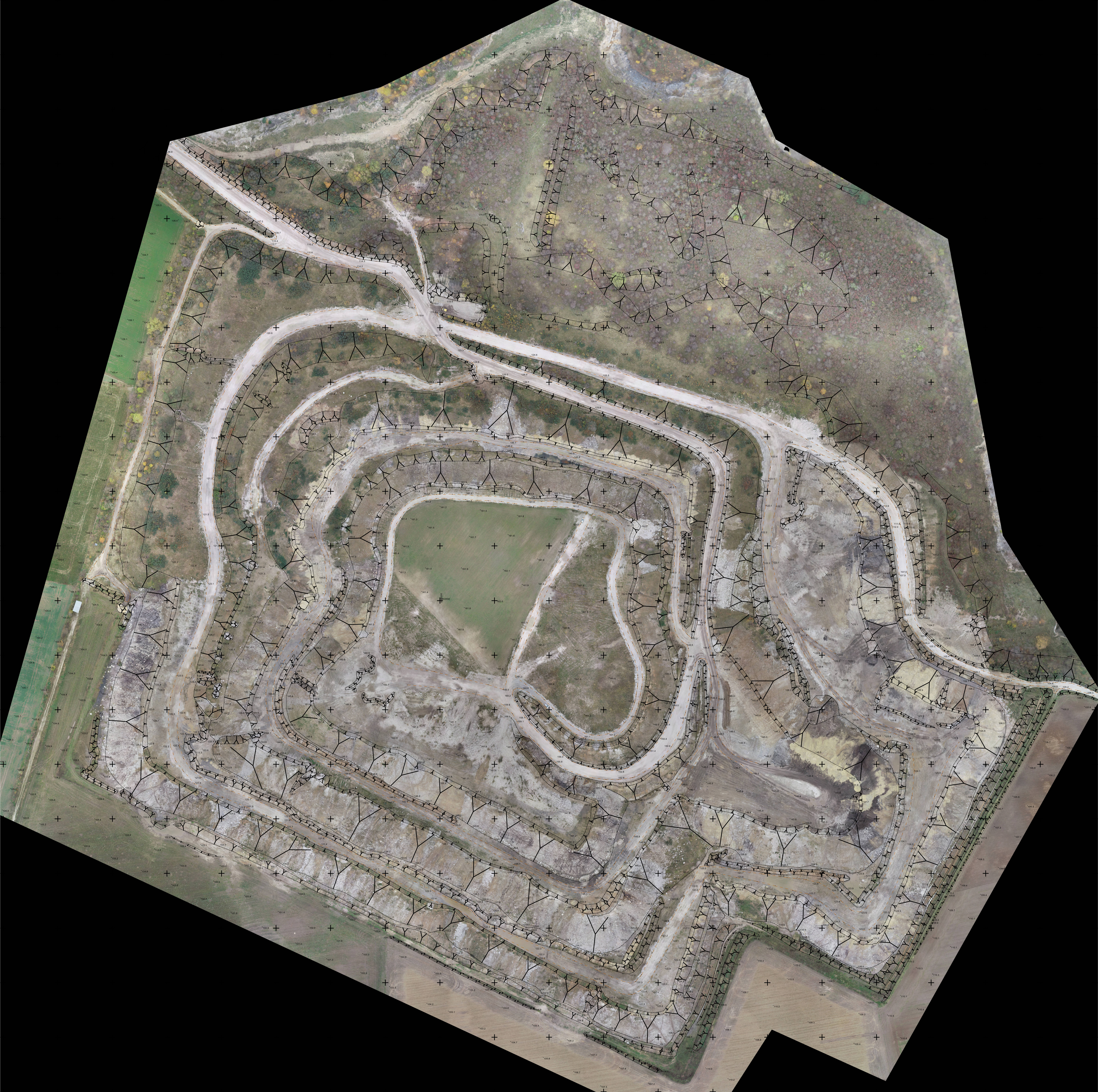
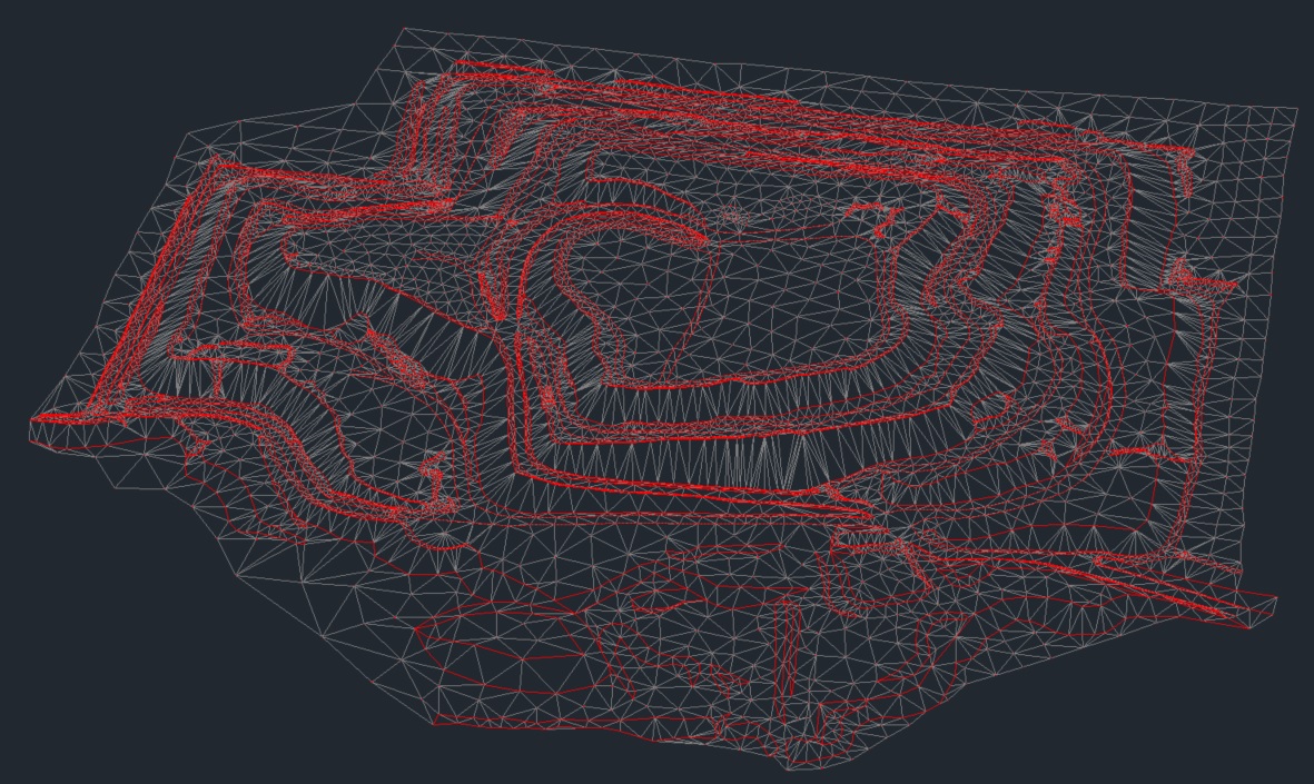
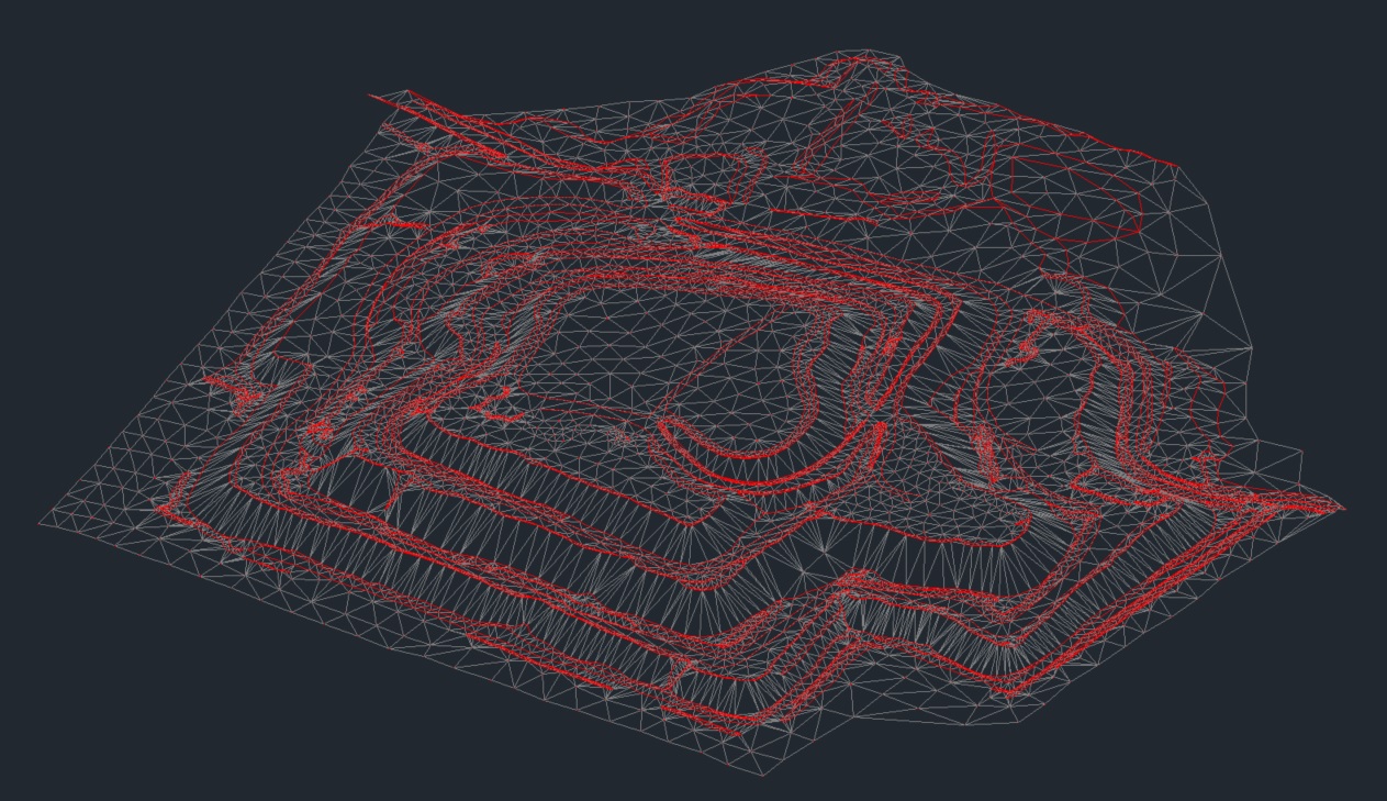
DIGITAL TERRAIN MODEL
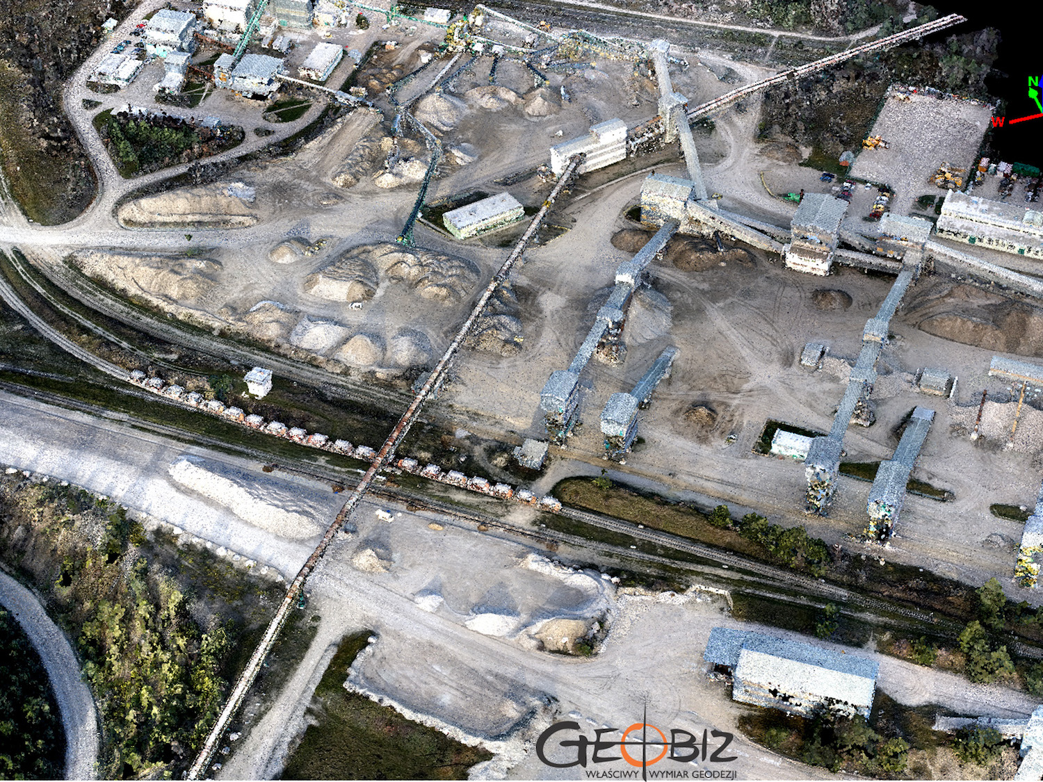
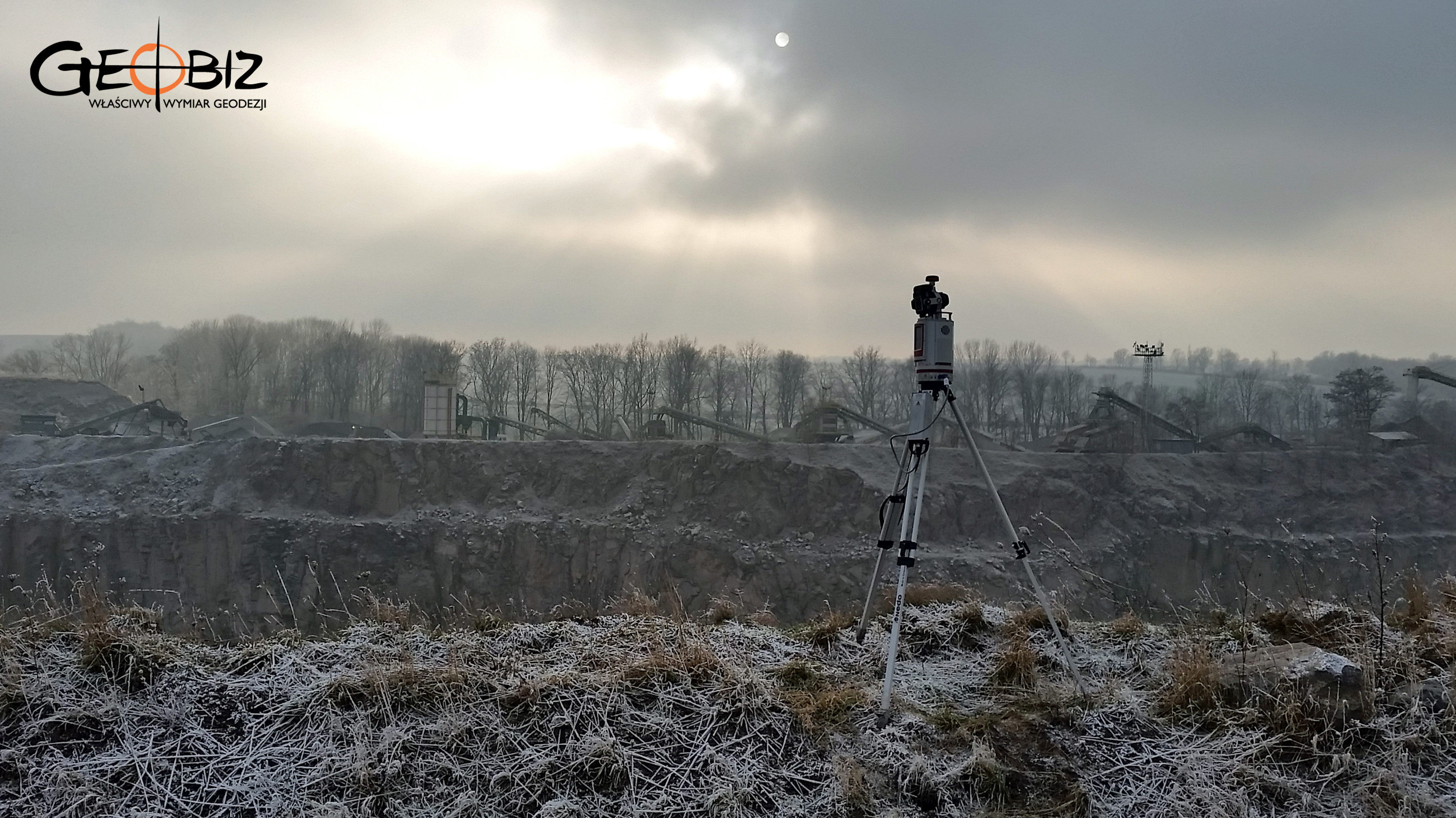
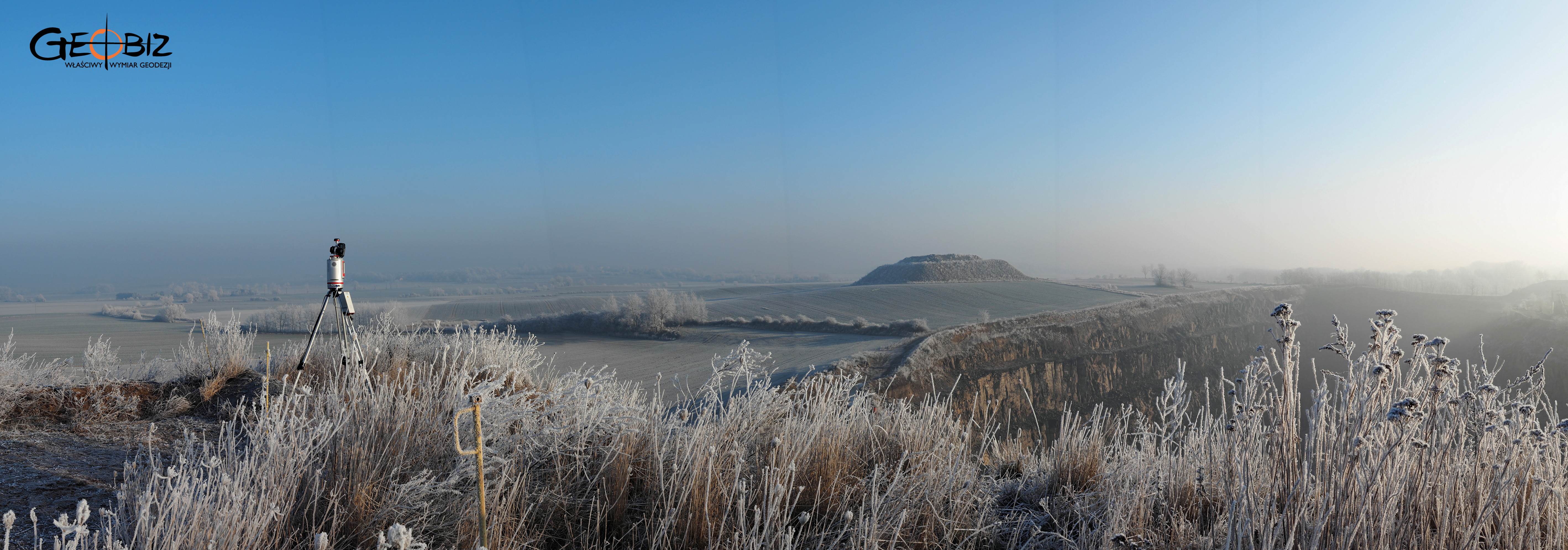
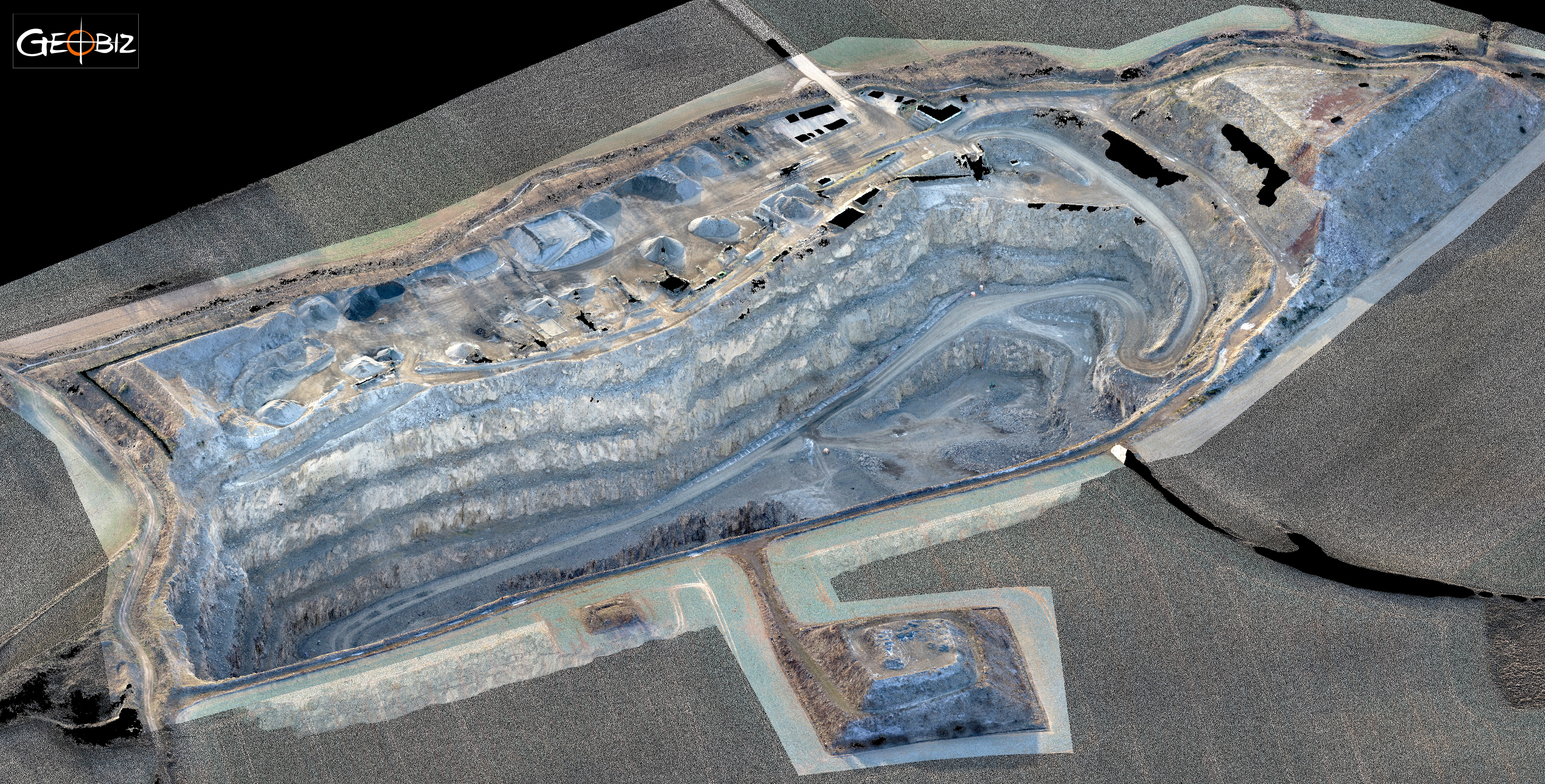
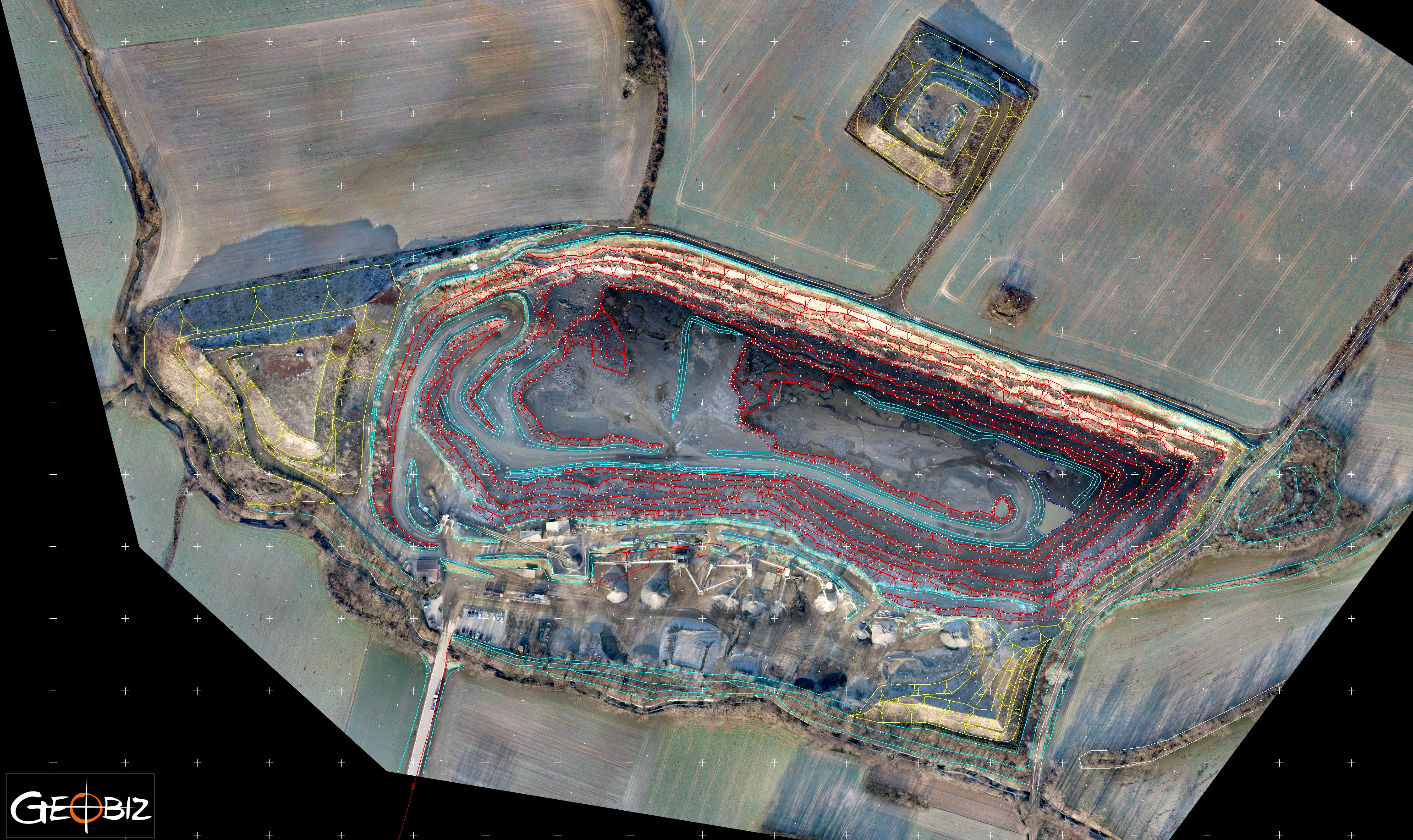
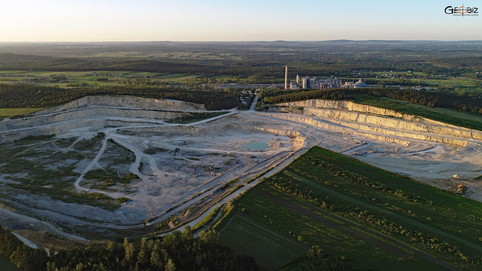
3D LASER SCANNING OF AN OPENCAST MINE
Using the methods of laser scanning and short-range aerial photogrammetry, we measured the basalt mine together with the adjacent area.
More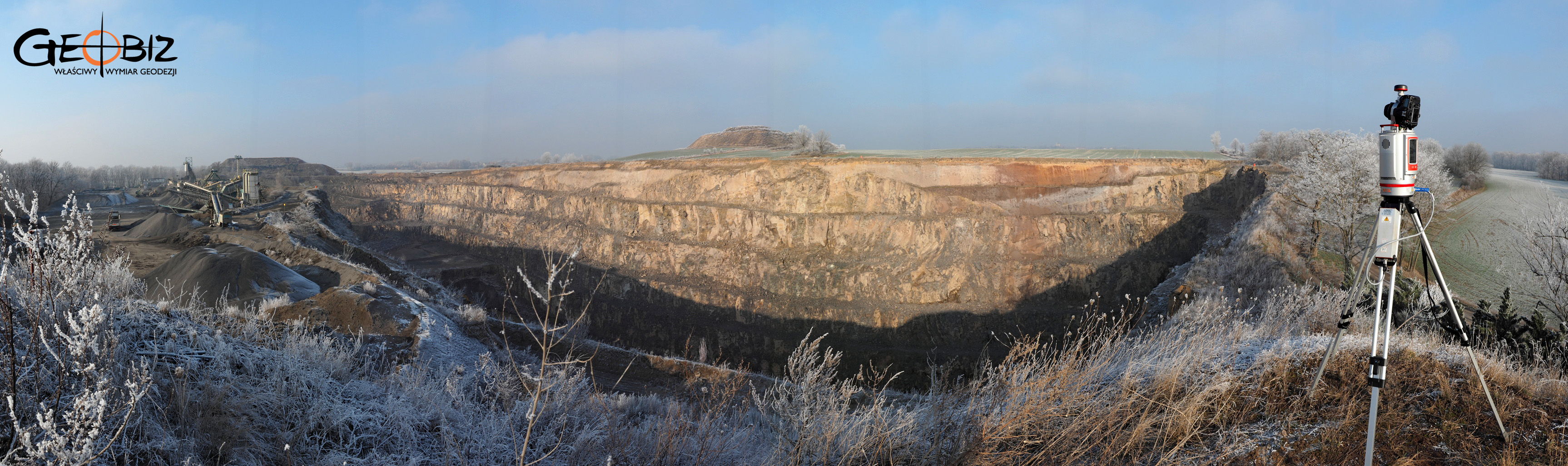
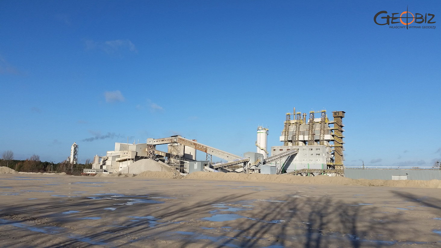
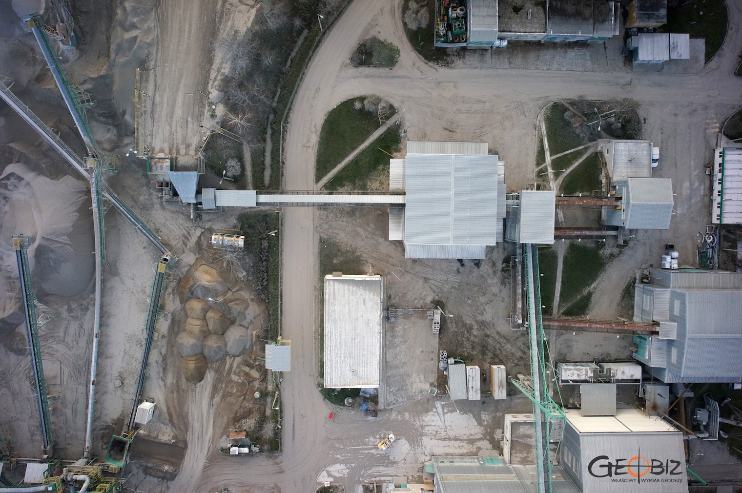
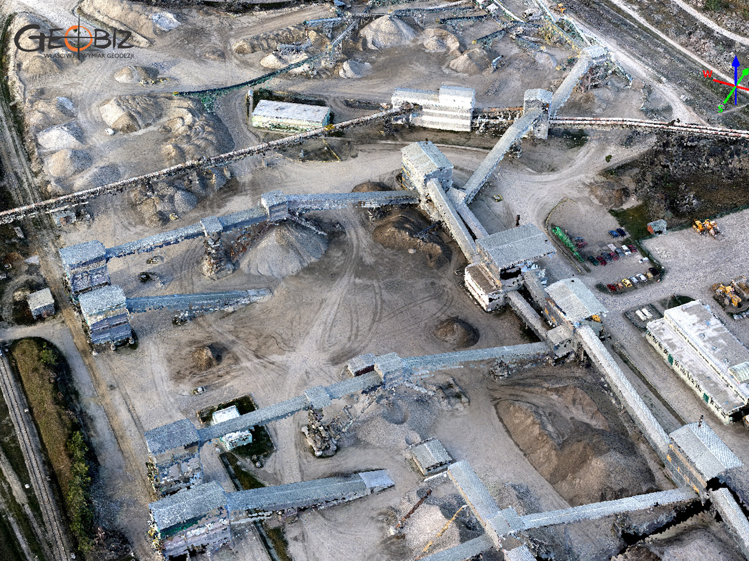
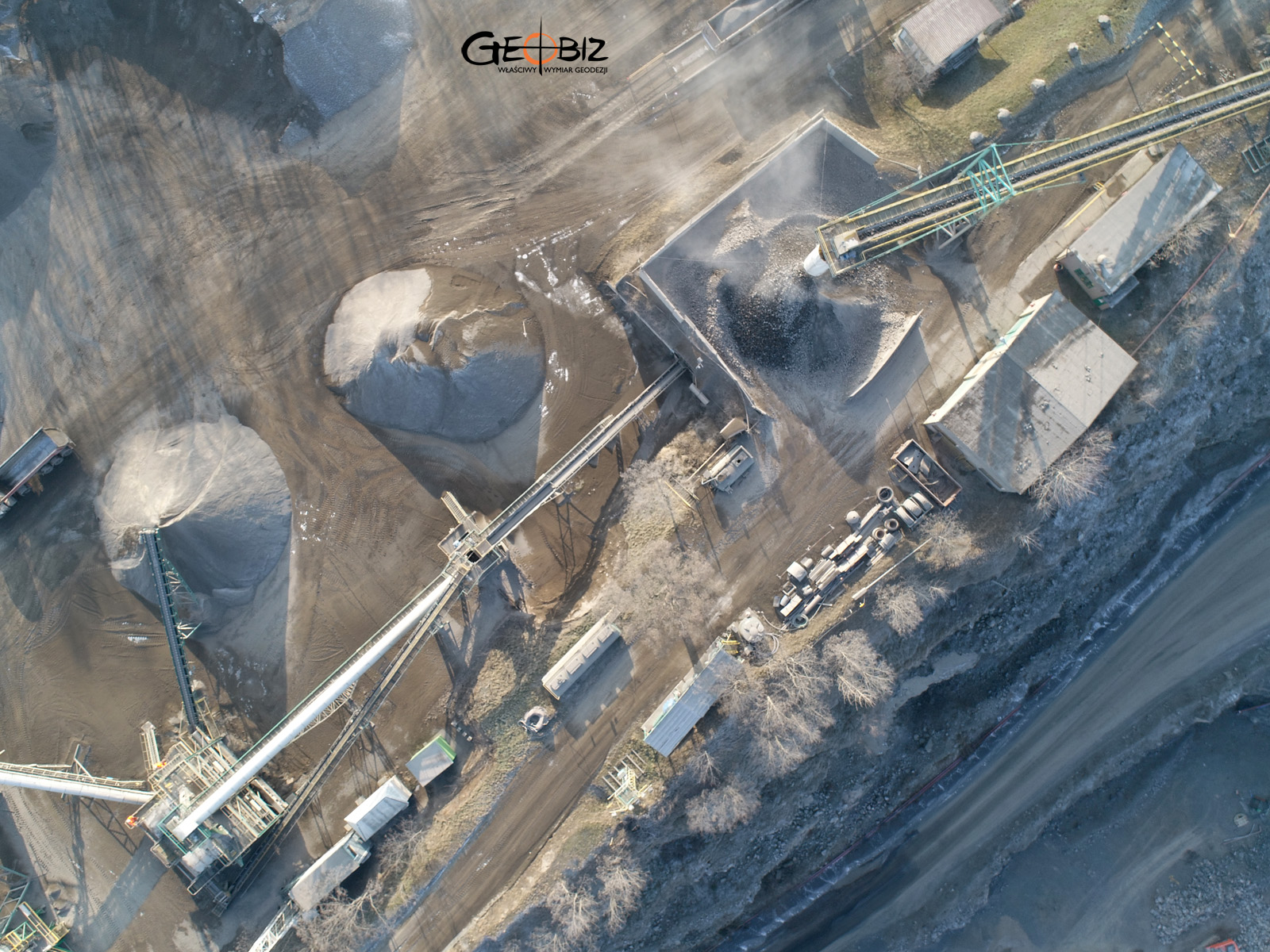
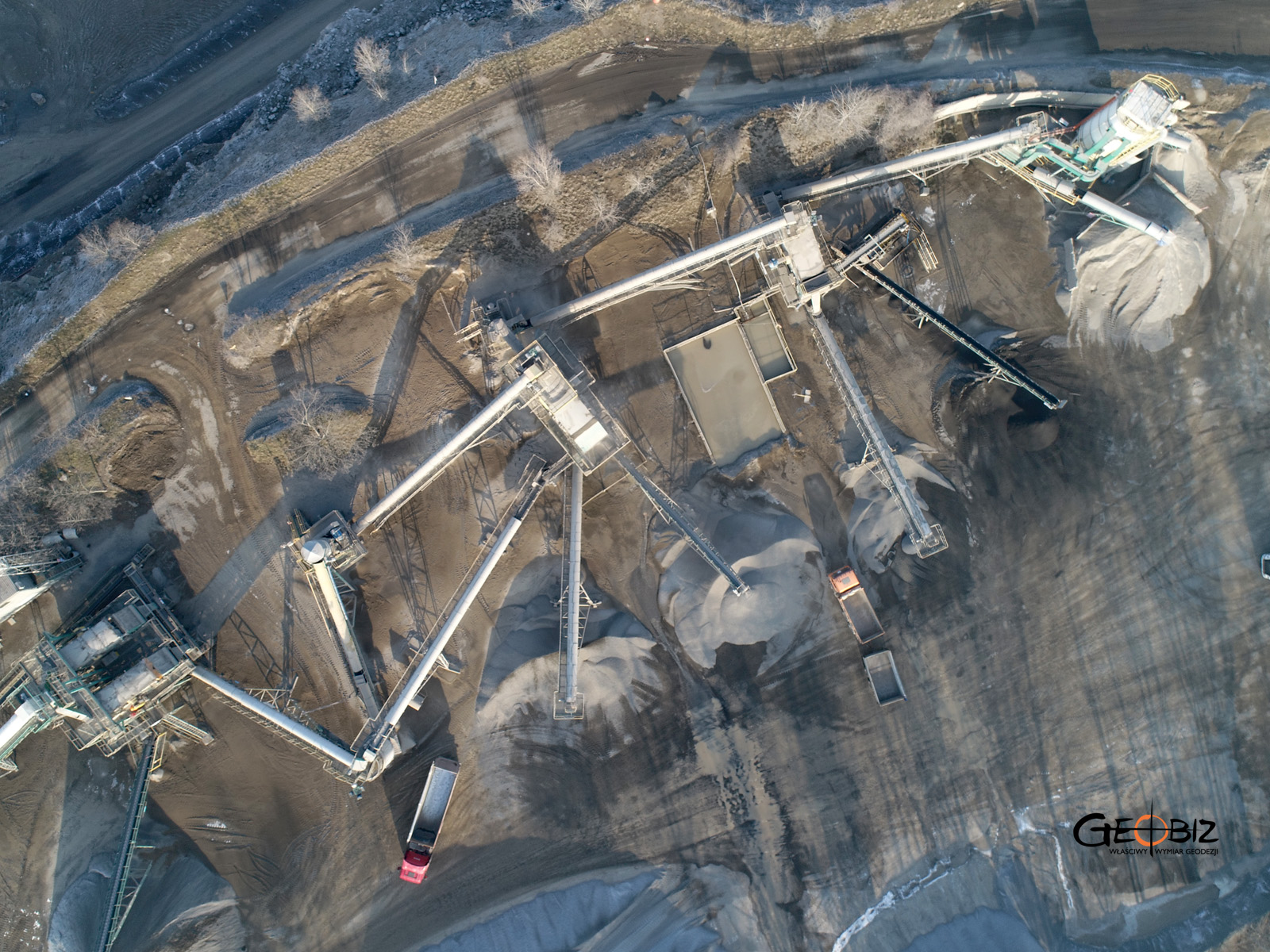
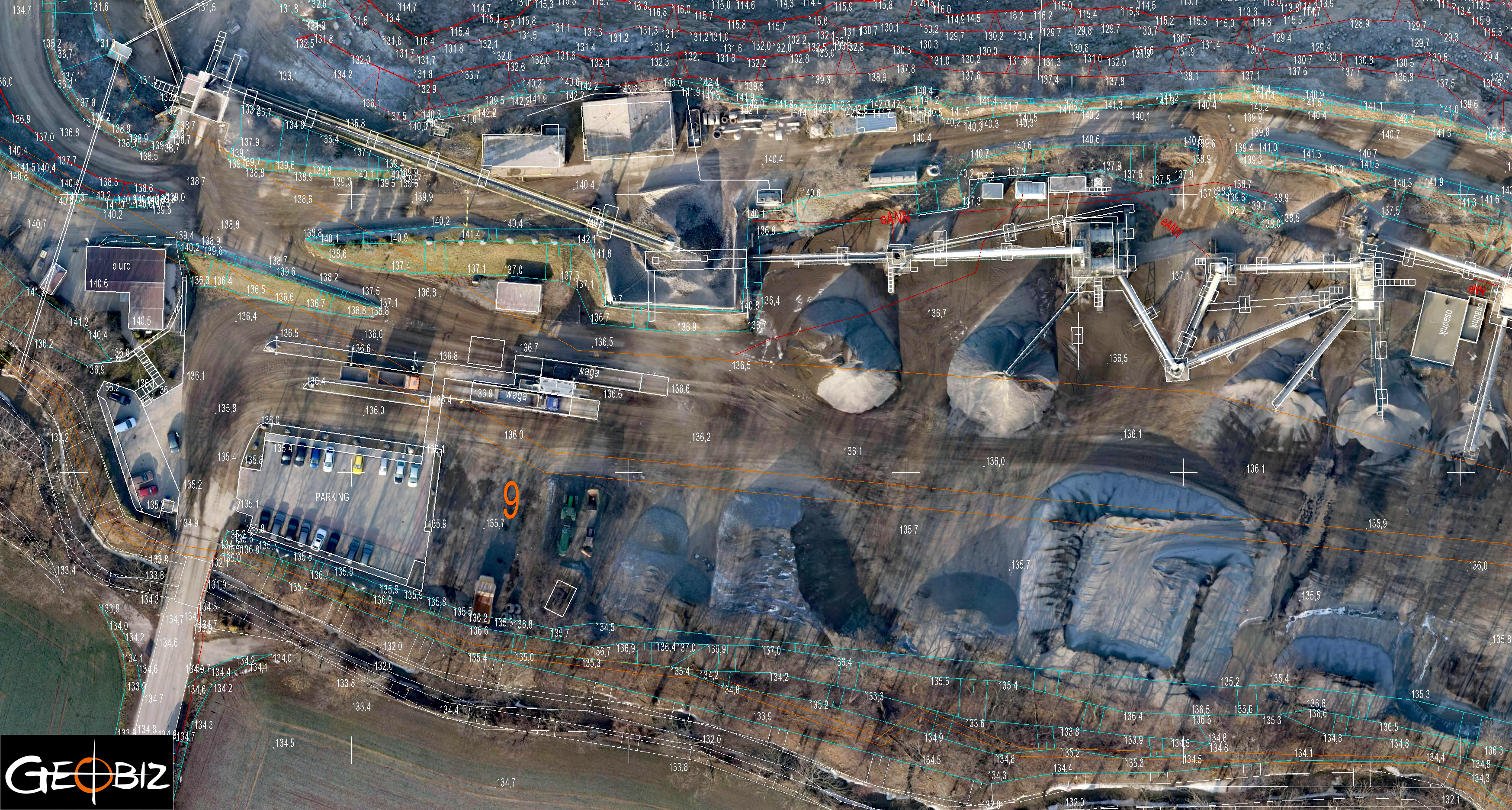
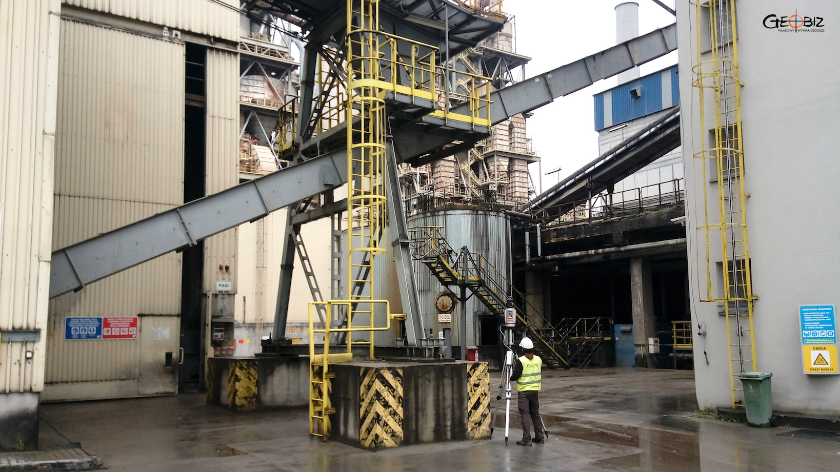
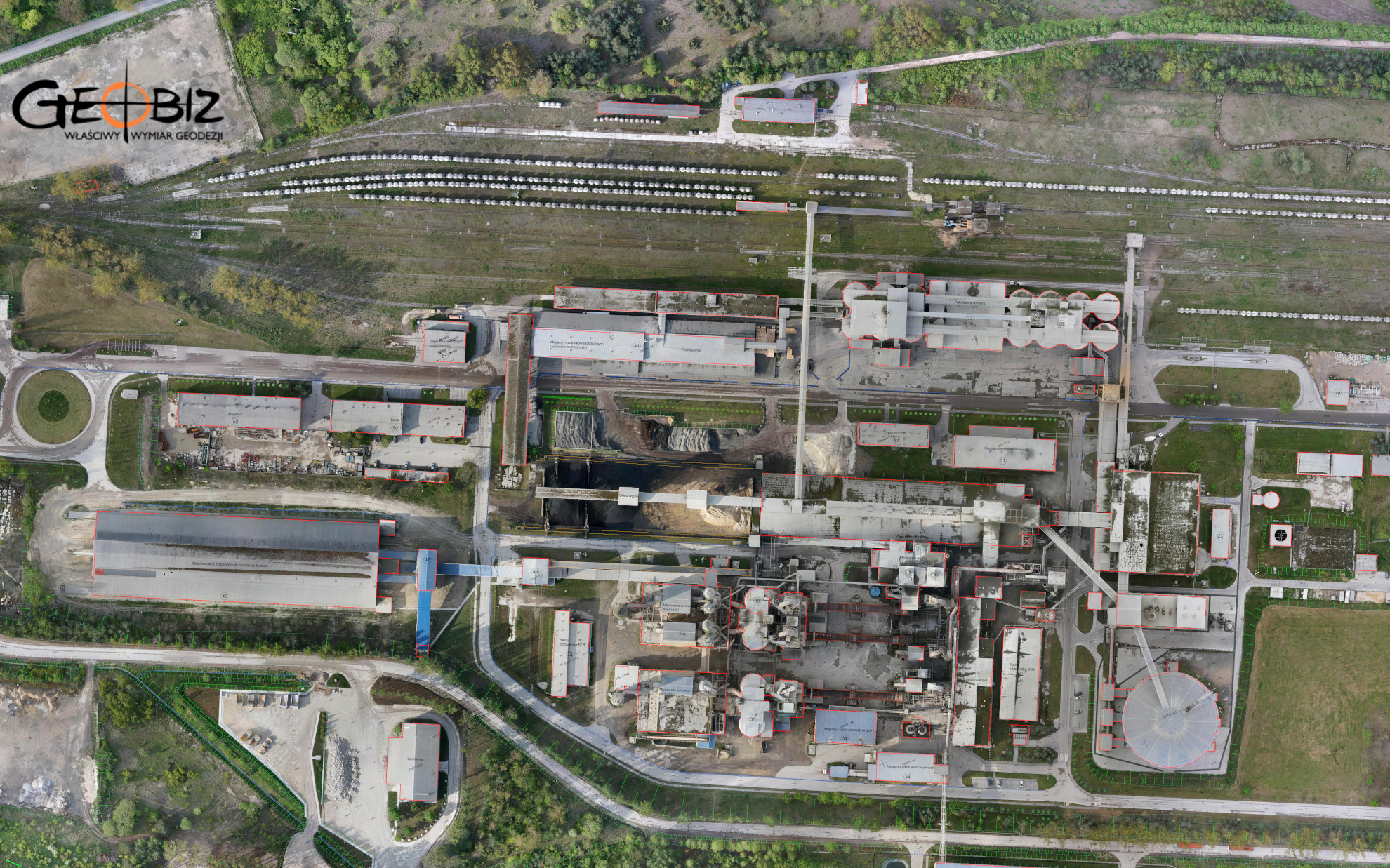
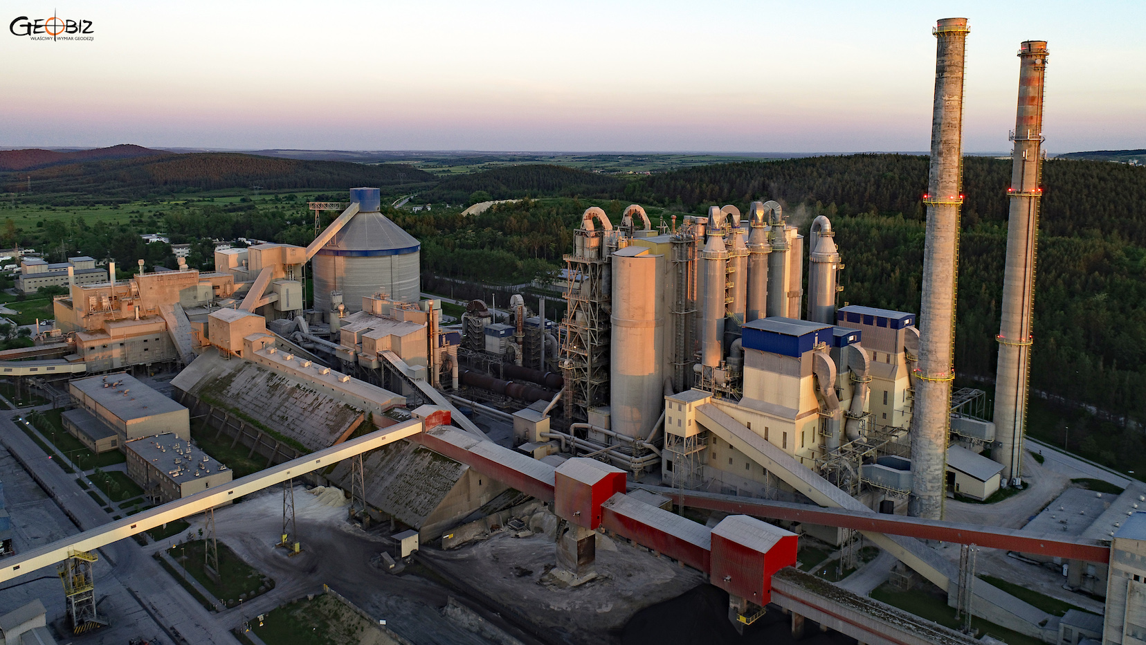
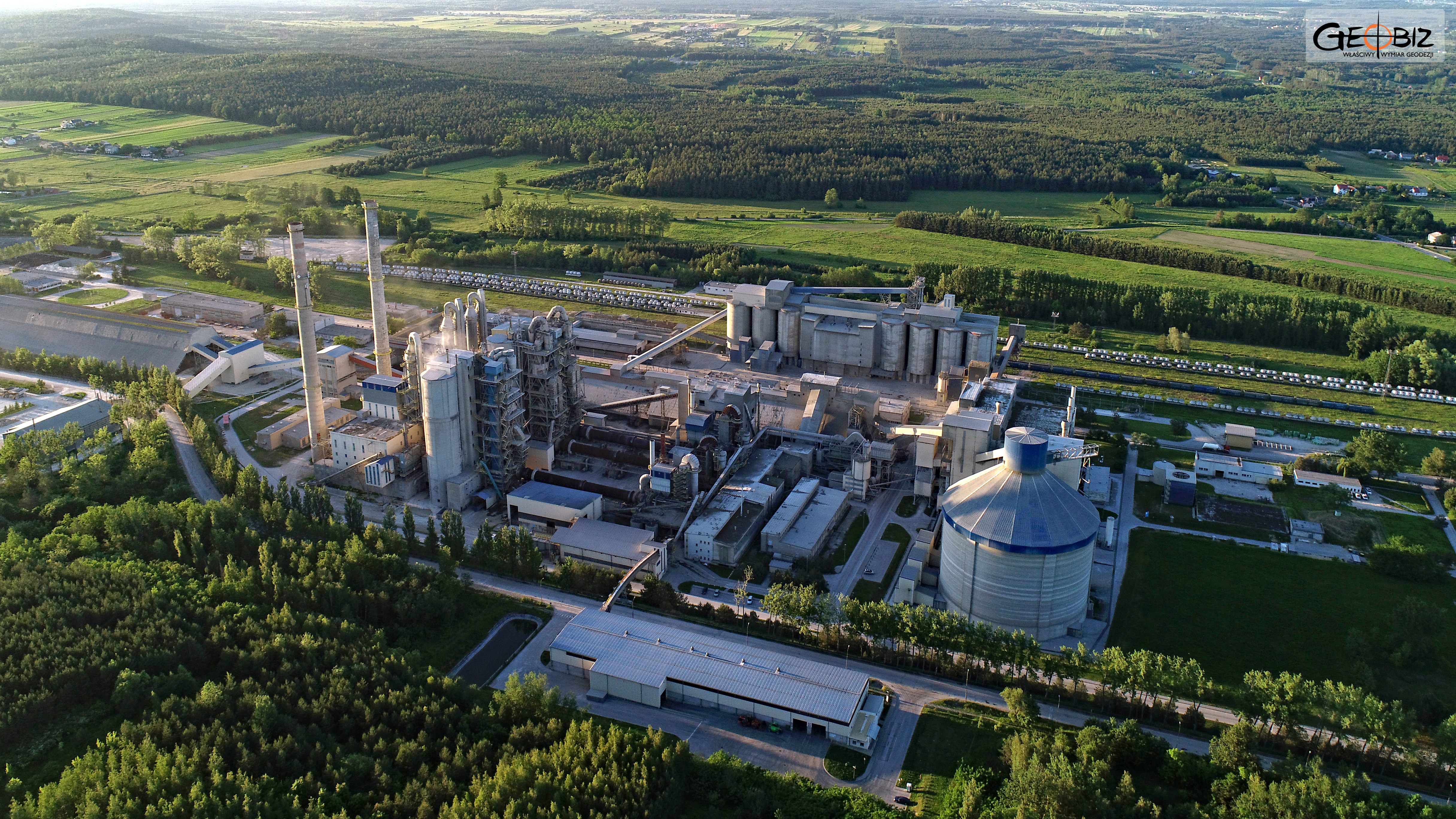
MODELING OF INDUSTRIAL PLANTS
Comprehensive development for design purposes of an industrial plant - 3D laser scanning, short-range photogrammetry, plant and opencast mine modeling.
More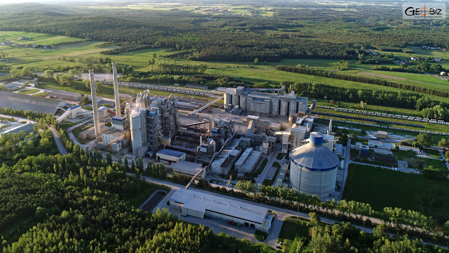
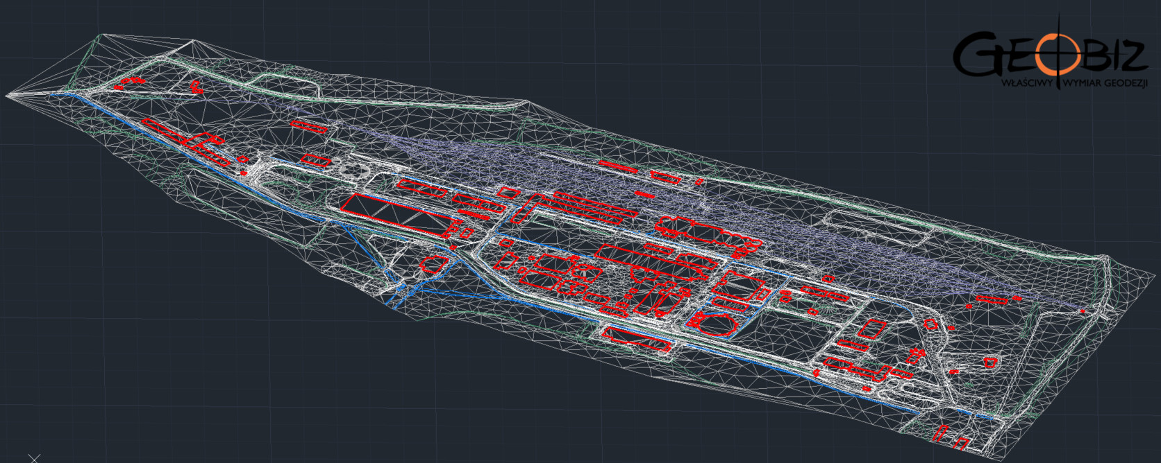
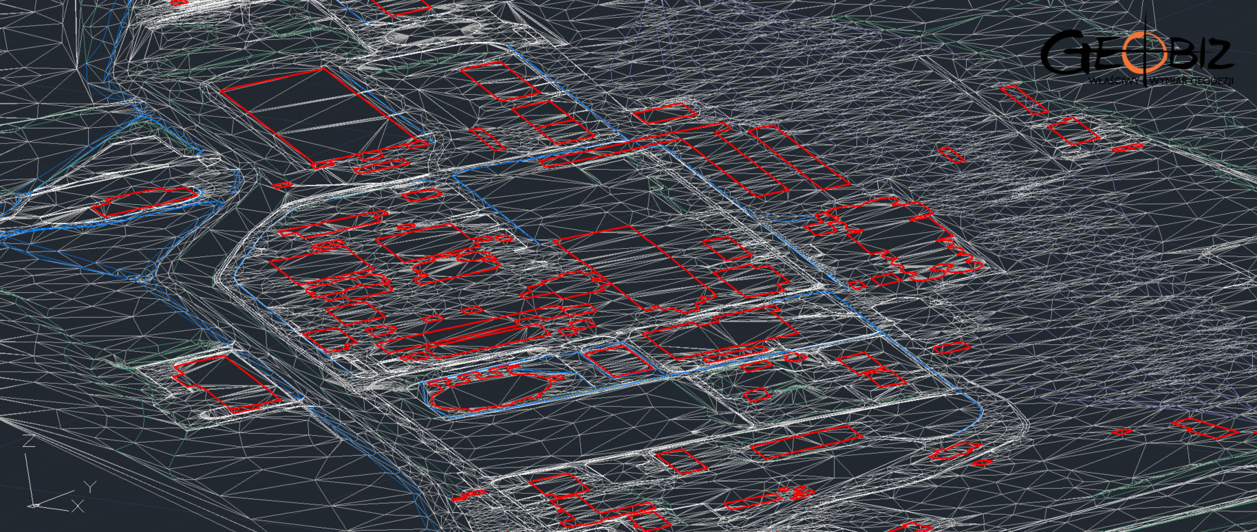
We specialize in creating Digital Terrain Models. We typically develop these by integrating data from aerial photogrammetry, terrestrial and aerial laser scanning, as well as data obtained through classical methods such as RTN GPS measurements or tachymetric surveys.
We have experience in modeling both urbanized areas, open-pit mines, and more straightforward agricultural and forested terrains. Usually, we create models either as an essential addition to maps for design purposes or as a basis for volume calculations.
CONTACT
We encourage you to send an inquiry, and we will prepare a personalized offer for you.